Residents of the Contra Costa County are fortunate enough to live close to Mount Diablo, many even able to see it from home. Countless people have enjoyed the hundreds of miles of trails that Mount Diablo and its surrounding foothills have to offer, and the extraordinary views that they can provide.
Over the last 50 years, Save Mount Diablo has been working to protect this natural wonder, preserving more and more of Mount Diablo and its surrounding open spaces.
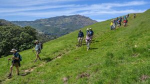
Hikers exploring some of the 170 miles of trails in Mount Diablo State Park. Photo by Scott Hein
But Mount Diablo is not alone; it is part of the Diablo Range, which spans 200 miles and has many other high peaks (some of which are taller than Mount Diablo).
If you’ve been atop Mount Diablo’s 3,849-foot summit on a clear day, then you might have been able to see some of them at a distance.
The Diablo Range at a Glance
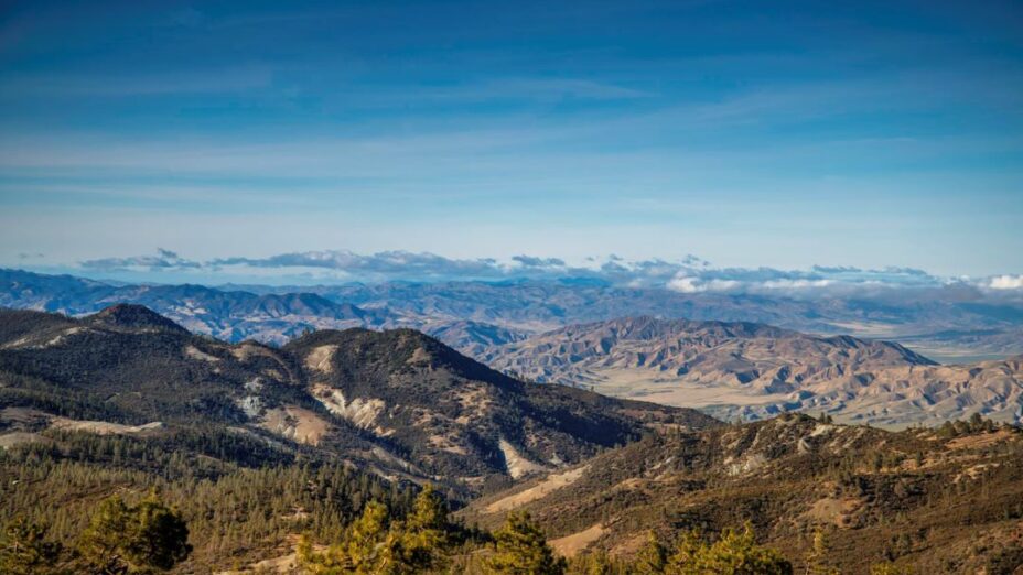
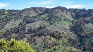
The Diablo Range is vast and beautiful. Photo by Scott Hein
The high peaks of the Diablo Range can be found as far south as Kings and Kern counties, ecologically attached to Mount Diablo through the incredible habitat connectivity of the Diablo Range.
Why are we so interested in peaks so far from Mount Diablo?
We can only truly protect Mount Diablo if we ensure that Mount Diablo continues to be connected with the rest of the Diablo Range, so we’ve been working to ensure that more of the Diablo Range is conserved.
Currently, a significant portion of the 200-mile-long Diablo Range is privately owned, and not easily accessible. However, the Bureau of Land Management owns more than 200,000 acres of land across the Diablo Range.
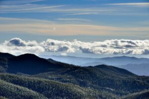
View from the top of San Benito Mountain. Photo by Al Johnson
Areas within the Diablo Range like Mount Diablo State Park, Henry W. Coe State Park, and San Benito Mountain give visitors an opportunity to experience the wonder of the Diablo Range, near or at some of its highest peaks.
Much of the Diablo Range consists of grasslands, chaparral, and oak savannas. It’s perfect habitat for raptors like kestrels and peregrine falcons, both of which can be found on Mount Diablo!
The northern Diablo Range also has the highest density of nesting golden eagles in the world.

Kestrel release near Mount Diablo. A number of raptor species such as kestrels rely on the Diablo Range. Photo by Mary Nagle
And Pinnacles National Park, farther south in the Diablo Range, is the epicenter of recovering California condors. Young condors are flying up and down the range looking for new territories.
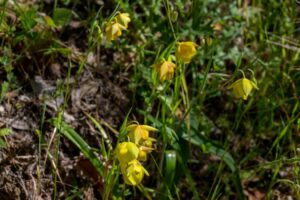
The Diablo Range is also home to numerous endemic and rare plant species thanks to the distinctive reddish-brown or greenish serpentine soils that can be found frequently throughout this region.
Because serpentine soil provides toxic conditions for most plants, plants that survive in this soil have had to adapt specifically to serpentine soil.
Fun fact: serpentine is officially California’s state rock!
North to South: Some of Diablo’s High Peaks
Let’s take a journey south of Mount Diablo and explore some of the other high peaks of the Diablo Range.
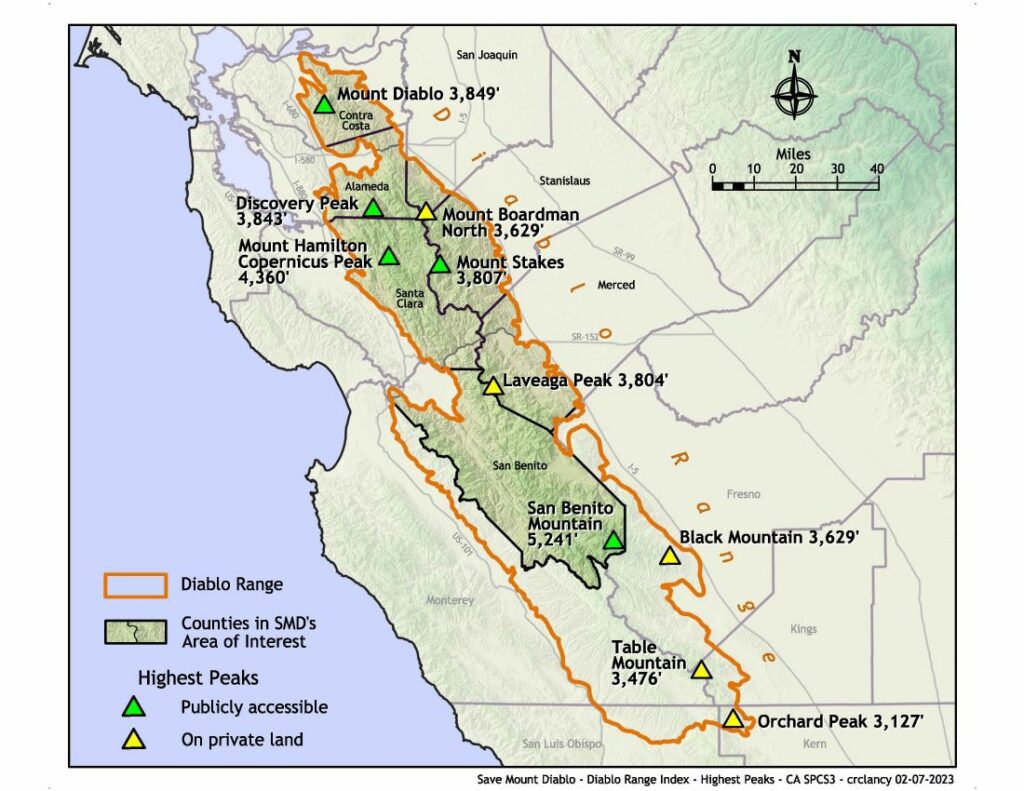
Map of the some of high peaks of the Diablo Range by Charles Clancy
Discovery Peak
Alameda County is where we find the most northern of these mountains, Discovery Peak, with an elevation of 3,842 feet.
Bay Area hikers may already be familiar with this one; it’s the highest point in Alameda County and has been known to get snow in the winter like Mount Diablo.
Mount Boardman
East of Discovery Peak, at the corner of San Joaquin County, stands Mount Boardman, the highest point of San Joaquin County at 3,842 feet.
Mount Boardman is currently on private land, so anyone who wants to summit this mountain needs to obtain permission from the owners.
This and Laveaga Peak are some of the privately owned high Diablo Range peaks within Save Mount Diablo’s current area of interest.
We currently do advocacy work in the seven northernmost counties of the Diablo Range (Contra Costa, Alameda, San Joaquin, Stanislaus, Santa Clara, Merced, and San Benito counties).
Copernicus Peak
Head back west to find Mount Hamilton’s Copernicus Peak, which reaches an elevation of 4,360 feet, making it the highest point in Santa Clara County.
Much like the North and South Gate roads on Mount Diablo, Mount Hamilton Road is an extremely popular way for cyclists to get close to Mount Hamilton’s highest points. Though Copernicus Peak cannot be legally accessed, Mount Hamilton Road can take you close.
Mount Stakes
People who visit the top of Mount Stakes can enjoy gorgeous views of Henry Coe State Park. Photo by Bruce Hamilton
Partly within Henry W. Coe State Park lies Mount Stakes, with an elevation of 3,807 feet. It’s located on the Santa Clara/Stanislaus county line and is the highest point in Stanislaus County.
Laveaga Peak
The next peak takes us into California’s central valley on the border of San Benito and Merced counties. Laveaga Peak has a summit reaching 3,804 feet of elevation. Laveaga Peak is currently privately owned by the San Benito Cattle Company.
San Benito Mountain

View from the peak of San Benito Mountain. Photo by Al Johnson
On the southern edge of Save Mount Diablo’s current area of interest lies San Benito Mountain, the tallest of the Diablo Range’s high peaks at 5,241 feet.
Thanks to its serpentine soils, it’s home to a treasure trove of endemic plant species, like the San Benito evening primrose.
San Benito County is overall a very special place to do conservation work.
Despite its small population of 67,000 people, San Benito County has almost as much land as Contra Costa and Alameda counties combined! The conservation decisions made there can make a big impact on the Diablo Range.
Black Mountain, Table Mountain, and Orchard Peak
Black Mountain at 3,629 feet, Table Mountain at 3,476 feet, and Orchard Peak at 3,127 feet all lie near the southernmost border of the Diablo Range.
They remain connected to Mount Diablo through the Diablo Range. It’s possible for a California condor to fly from Orchard Peak to Mount Diablo in just a day.

Cartography by Sahoko Yui and range boundary by Heath Bartosh. Sources for property boundaries from: California Protected Lands Database 2018 and 2019; Dept. of the Interior; Dept. of Defense; Dept. of Energy; San Joaquin, Santa Clara, Stanislaus, and Merced counties; SCVOSA; Zone 7.
Protecting the Diablo Range is California’s next great conservation story. Right now, only 24 percent of the full range has any protection.
It’s a biodiversity refuge with high peaks; volcanic, serpentine, and sandstone rock; and some of California’s rarest plants that most people don’t know anything about.
Mount Diablo globe lily, a rare flower endemic to Mount Diablo. Photo by Scott Hein
Top photo by Stephen Joseph

