
By Steven dePaschalis and Seth Adams
In the rolling eastern hills of Alameda County, California, Altamont Pass is a natural divide between two worlds: the fertile, urbanized Livermore Valley to the west and the arid, agricultural San Joaquin Valley to the east.
The landscape is influenced by tectonic uplift creating the coast ranges, erosion from winter rains that carves the ridges into peaks and passes, and nearly constant winds from the west that support hunting birds and thousands of windmills. It is raptor heaven.
This narrow corridor, a mere seven miles wide at its slimmest point, stretches from the Los Vaqueros watershed south to Corral Hollow.
For millennia, it has been a critical thoroughfare. It is a landscape where the migrations of wildlife meet the ambitions of human expansion.
However, this story is also one of conflicting interests, one of progress tempered by ecological loss. Today, the fate of the Altamont hangs in balance, as conservation groups like Save Mount Diablo work to protect its wild nature for future generations.
For years, we have been determined to protect the Altamont, to make sure Mount Diablo is never cut off from the rest of the Diablo Range. Otherwise, we will lose a lot of the wildlife that makes Mount Diablo distinctive, especially apex predators.
Recently we have been getting more serious: protecting Altamont is now one of our top three acquisition goals.

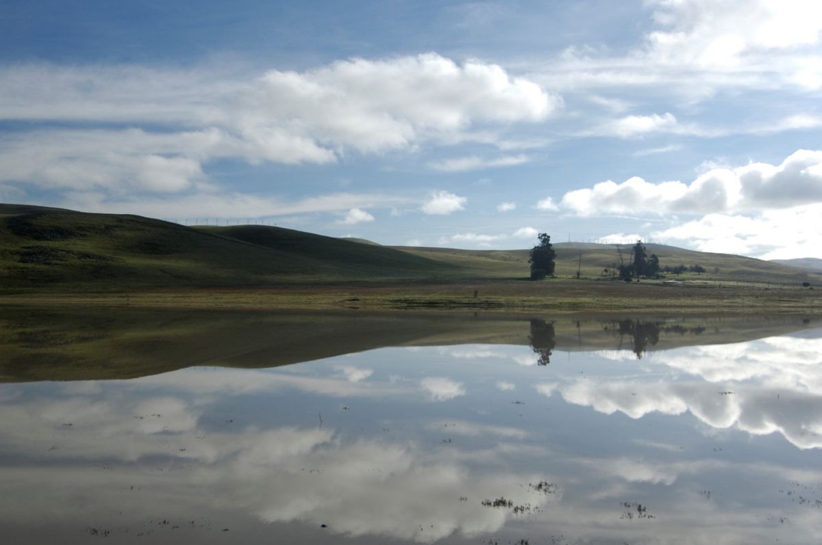
View of the rolling hills of the Altamont from Patterson Pass Road. Photo: Steven dePaschalis
The Altamont Is a Critical Diablo Range Linkage Point
Stretching over 205 miles from north to south, the Diablo Range is one of California’s most significant ecological features, and Altamont Pass is its narrowest and most crucial bottleneck.
Altamont Pass is the single most important wildlife corridor connecting Mount Diablo and its adjacent parks to the rest of the Diablo Range.
For species large and small, it is a critical pathway for migration and gene flow. Without the Altamont, the northernmost part of the range would be effectively cut off from the south, with devastating consequences for biodiversity.
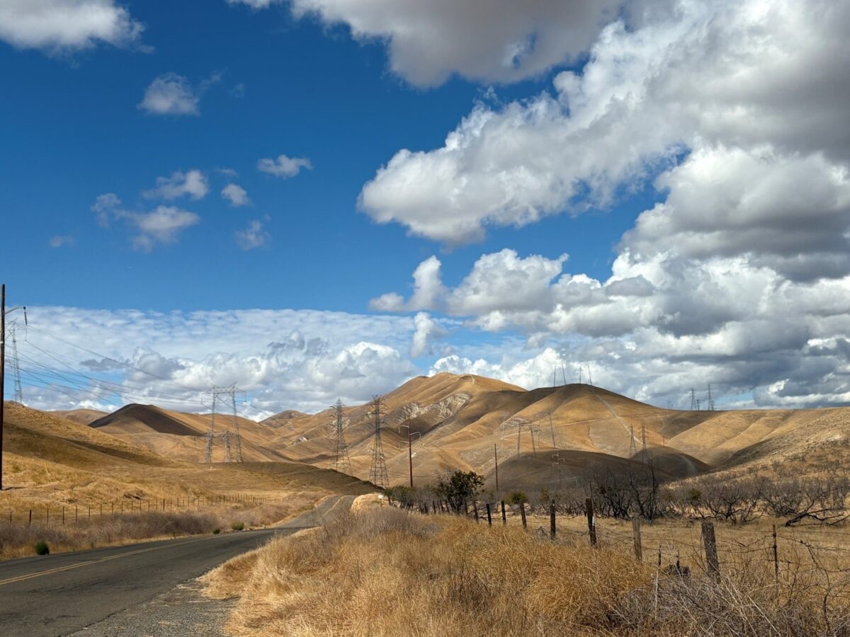
The visible landscape of the Altamont is heavily impacted by human infrastructure.
The whirring blades of wind turbines, a network of transmission corridors, the iron tracks of freight and commuter rail, and the serpentine aqueducts carrying water across the state all dominate the scenery.
Mixed into all this, a complex ecosystem struggles to survive. Urban encroachment from the rapidly expanding cities of Livermore and Tracy puts constant pressure on the surrounding rural lands.
Though Alameda County’s large agricultural parcels have historically provided a buffer, the threat of new development and habitat destruction remains ever present.
Frick Lake in Brushy Peak Regional Preserve, one of the few parks in the Altamont area. Photo: Scott Hein
A Landscape of Profound Ecological Change
For thousands of years, Altamont’s ecosystem was shaped by the rhythms of nature.
Native American tribes, including the Ohlone and Yokuts peoples, moved through these hills along ancient trade routes, likely following vast herds of tule elk and pronghorn that once roamed the area.
They exchanged goods and lived in harmony with the seasons, recognizing the intrinsic value of the land.
The ecological balance of the Altamont has been profoundly altered over the last 250 years, primarily by human activity. Decades of intensive ranching, cattle grazing, and other agricultural practices have reshaped the hillsides.
Roads and aqueducts cut through the landscape and create manmade edges, with road corridor crossings at Altamont Pass Road, Highway 580, Patterson Pass Road, and Tesla and Corral Hollow roads.
Arguably, the most significant ecological disruption came with the introduction of non-native grass species. Today, species like soft chess and ripgut brome dominate the landscape, crowding out the native grasses that once supported a more diverse ecosystem.
This shift in vegetation has had a cascading effect, contributing to the local extinction of species such as the federally endangered San Joaquin kit fox.
As invasive grass species have altered habitat, small mammal species that kit fox prey on have either relocated or can no longer live in the Altamont area.
With the kit fox now absent, its role in the ecosystem has since been filled by more adaptable species like coyote.
The last kit fox recorded in the East Bay was in 1992. Extensive surveys conducted with scat-detection dogs and aerial surveys in 2002 found no evidence of kit fox activity in either Contra Costa or Alameda counties.
A Battlefield for Conservation
The Altamont is still a remarkably biodiverse hot spot, most famously known for its exceptionally dense population of nesting golden eagles.
The constant wind and treeless landscape create an ideal hunting ground for these magnificent raptors and other birds of prey, including kestrels, falcons, vultures, and various owl species.
They “kite” on standing waves of winds above the ridges, hovering while hunting with little energy expenditure. High vantage points like telephone poles provide unobstructed views for spotting prey.
Healthy populations of primary consumers, such as rabbits and ground squirrels, help sustain this impressive avian predator population.
The ecological suitability of the Altamont area for raptor species is so impressive that California condors have returned for the past five years.
Their return to Altamont and other areas of the East Bay follows a hundred-year absence and extensive restoration efforts in Pinnacles National Park and Big Sur.

California condors, for over a century absent in the Altamont and surrounding East Bay landscape, have been recorded flying through these areas for the past five years. Photo: Jean Beaufort
Yet, this wild haven is also a battlefield. For decades, the Altamont Pass Wind Resource Area was infamous for its devastating impact on raptor populations.
The thousands of older, poorly sited turbines installed in the 1980s were a death trap for birds, leading to massive mortality rates and tarnishing the reputation of renewable energy.
Repowering projects have replaced many older units with more bird-friendly turbines, however, and new sensors turn off wind turbines when eagles, condors, and other raptors are nearby.
Still, many raptors die every year from turbine-related deaths, and appropriate placement is important even for “green” energy.
The Challenges of a Fragmented Landscape
Beyond the turbines, human infrastructure continues to fragment the Altamont landscape. Interstate 580 is an impassable barrier for many species.
The Altamont landfill splits the corridor in half but will eventually close. In the meantime, a tipping fee on the garbage is collected and allocated for acquiring land or conservation easements in areas near Livermore, Pleasanton, and Dublin.
On either side of the interstate, private parcels, fencing, and invasive species have fragmented the landscape, but conservation easements on ranches will be our biggest aid in maintaining the corridor.
The construction of aqueducts, like the California and South Bay aqueducts, adds to this network of obstacles, further disrupting natural movement patterns, yet also offering long linear corridors from which to build upon.
The pressure from nearby urban areas is intensifying. The best wildlife corridor opportunities are highway undercrossings on the east and west edges of the pass.
Development projects threaten to permanently damage remaining critical habitats.
Examples include the expansion of Altamont Motorsports Park—which Save Mount Diablo helped stop in 2007—and a stalled annexation of 1,100 acres of undeveloped wildlife habitat east of Greenville Road by the City of Livermore.
Studies on the wildlife abundance in the Greenville Road area are becoming increasingly important to inform conservation efforts but can only go so far.
We want to reconnect wildlife populations of species like mountain lions, not just confirm their presence or absence.

A cattle tunnel under Vasco Road in the Altamont area, one of the few places where wildlife can bypass road barriers. Photo: Scott Hein
Fighting the Good Fight
Confronting these threats requires a multifaceted effort. Organizations like Save Mount Diablo and our partners are at the forefront of this work, focusing on land protection, habitat restoration, and wildlife-friendly infrastructure.
One of the most effective tools is the conservation easement, a legal agreement that restricts development on private land to protect its natural features.
By securing these easements, conservation groups can permanently protect critical habitat from the pressures of urban sprawl.
As one of its top three priorities, Save Mount Diablo is actively looking for properties to protect in the Altamont, especially ones that enhance wildlife connectivity.
A key player will be Caltrans, which has deep pockets to enhance wildlife connectivity when contemplating freeway improvements.
A half dozen major crossings of Highway 580 offer wildlife connectivity opportunities, with a dozen or more smaller ones like culverts or cattle tunnels.
Historical victories also give blueprints for future success.
The East Bay Regional Park District has protected Brushy Peak Regional Preserve at the western edge of Altamont Pass, north of Highway 580, and Del Valle Regional Park to the south.
We are currently urging the park district to create an Altamont Pass Regional Preserve to help with connectivity.

Brushy Peak Regional Preserve in the Altamont area. This preserve was opened in 2005 by the East Bay Regional Park District. Photo: Scott Hein
The Contra Costa Water District’s 20,000-acre Los Vaqueros watershed also sits at the north end of Altamont Pass. A collection of agencies has protected more than 20,000 acres in Corral Hollow, anchoring the south edge of the bottleneck.
In response to the 2011 Los Vaqueros Reservoir expansion, Save Mount Diablo collaborated with the Contra Costa Water District to protect over 6,000 acres of land as mitigation.
This effort not only secured habitat in the Altamont but also included two cattle tunnels, the first protected wildlife crossings under Interstate 580, reconnecting fragmented landscapes.
The transformation of a bankrupt golf course into restored wildlife habitat by the Contra Costa Water District also shows the potential for remediation.
The work to preserve the 3,100-acre state park land known as “Tesla,” which bridges our Altamont rewilding and Diablo Range conservation objectives, is an example of the long-term commitment conservation projects often require.
After 20 years of intense advocacy at the local, regional and state level by a broad coalition, including Save Mount Diablo, legislation was finally passed in 2021 to prevent Tesla from being opened as an expansion of Carnegie State Vehicular Recreation Area.
Tesla, located south of Tesla Road, is a priority conservation target because of its natural (and cultural) resources of statewide significance, holding exceptionally rare biodiversity, the critical linkage habitat corridor running from Mount Diablo south along the Diablo Range, plus much more.
The legislative win was a major step, but there is more required to achieve real lasting preservation of Tesla. Now, with the Friends of Tesla Park coalition, Save Mount Diablo continues fighting the good fight to ensure that Tesla is preserved at the highest level as a state natural reserve so that in the future, we do not face attempting to “rewild” this irreplaceable natural landscape.
Most of these conservation victories come with immense help from the Altamont Landfill Open Space Fund, which was formed after the expansion of the Altamont landfill. The fund, run by the Altamont Landfill Open Space Committee, distributes funding to parties looking to acquire properties of significant value for preservation of native biological diversity or wildlife habitat.
The Alameda County Resource Conservation District, with funding from the Altamont Landfill Open Space Committee and in collaboration with the Road Ecology Center at UC Davis, started collecting data in 2018.
Their goal is to address wildlife permeability and safety along major transportation corridors in Alameda County.
Roads present significant dangers to wildlife and motorists, as evidenced by a substantial number of wildlife-vehicle collisions, many of which go unreported.
These collisions are a major cause of mortality for various species, contributing to habitat fragmentation and limiting wildlife movement.
Roads not only cause direct harm but also create noise pollution, introduce invasive species, and contribute to habitat degradation through their construction and related activities.
Studies show that wildlife overpasses and underpasses, particularly when paired with fencing, can significantly reduce collisions and enhance habitat connectivity, although their effectiveness can vary depending on species and design.
Roads and fencing pose some of the largest fragmentation issues in the Altamont. Photo: Steven dePaschalis
In 2023, the Alameda County Resource Conservation District received a grant from the Wildlife Conservation Board for a 3.5-year project aimed at identifying four suitable sites along Interstate 580, Interstate 680, and Highway 84 for the construction of wildlife crossing structures.
This project has the potential to enhance regional wildlife connectivity and reduce conflicts between wildlife and human infrastructure.
The Tri-Valley Conservancy is also protecting land on the Livermore side of Altamont Pass. Just recently, the California Rangeland Trust acquired a conservation easement on the Sweet Ridge Ranch in Altamont using Altamont Landfill Open Space Fund funding.
Altamont’s Hopeful Future
Keeping Altamont wild is one of Save Mount Diablo top priorities. Our expertise in land use advocacy is our major strength.
By exploring environmental mitigation strategies to offset impacts from wind turbine development or working with local agencies to open new parks in Altamont, our goal is to turn the thinnest slice of the Diablo Range into a thriving, protected, better connected landscape.
Save Mount Diablo is also working to educate the public and stakeholders about the importance of Altamont.
Through programs like the Diablo Conservation Experience, we are helping students and community members understand the Diablo Range and the critical wildlife bottleneck in the Altamont area.
Our Discover Diablo hikes, BioBlitz events, and interpretive programs also connect people to the landscape.
Our long history of stewardship, from habitat restoration to invasive species management, will also allow us to bring conservation expertise in protecting Altamont’s natural resources.

A map showing some public lands (green), lands protected through conservation easements (crosshatched), and unprotected (white) parcels in the Altamont area. Map: Save Mount Diablo. Note that not all public land is protected, as Carnegie State Vehicular Recreation Area is shown as green.
With continued effort from Save Mount Diablo and our collaborators, we will make certain that Altamont’s next chapter fulfills our critical mission: making sure Mount Diablo and its wildlife are never cut off from the rest of the Diablo Range.
About the Authors
Steven dePaschalis joined Save Mount Diablo in 2025. He grew up in the Bay Area and has always had an immense passion for being in nature. In college, he studied environmental science and management and graduated with a bachelor of science degree from UC Davis. In his free time, Steven loves to read, hike, and run. He lives in Oakland, California.
Seth M. Adams is the Land Conservation Director for Save Mount Diablo, where he has worked since 1988 as the organization’s first staff member. He has helped protect tens of thousands of acres, establish Urban Limit Lines, and shape major conservation plans across the East Bay. He is now focused on Save Mount Diablo’s expansion to defend and protect the 200-mile Diablo Range. An avid hiker, weightlifter, and amateur historian, he lives in Martinez, California.
AI Statement
This article was partially refined using AI editing tools to enhance readability and consistency, with all final content reviewed and approved by the authors.
This blog post was updated on December 12, 2025.

