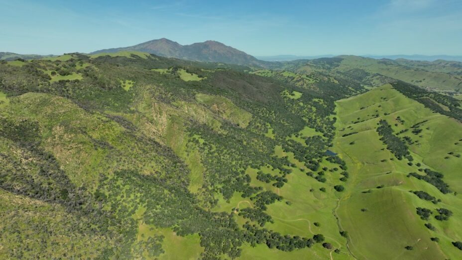
Cooper Ogden is a freelance drone photographer who has been working with Save Mount Diablo to document the East Bay’s landscapes for years. His photography helps us advocate for the protection of our local open spaces and wild lands.
Since 2021, he’s been photographing the rugged and dynamic landscapes of the northern Diablo Range for Save Mount Diablo’s Diablo Range Revealed project.
His work helps showcase the beauty and importance of areas like Pittsburg’s southwest hills and Del Puerto Canyon, which are threatened by proposed projects.
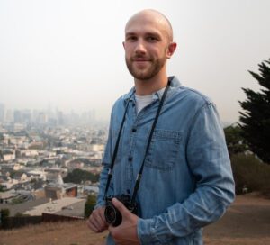
Cooper Ogden
Meet Cooper
When did you become a photographer?
I had toy cameras as a kid; it goes back to nearly the beginning. I started taking pictures when I was three or four, and it kind of just continued through that.
Having this incredible landscape so close to home particularly influenced my interest in landscape photography.
What is the most memorable project you’ve done for Save Mount Diablo?
I think it’s been much of the Diablo Range Revealed work.
Ever since 2020 until now, each spring I’ve been returning to various locations in the SCU fire complex area to photograph them.
It’s been really cool because I’ve gotten to witness the beginning of this land recovering, which is really an impressive thing to watch and to become really intimately familiar with some of these locations that I’ve been visiting for the past few years.
I’ve been able to see parts of the Diablo Range that I didn’t even know existed, which has been really rewarding. I’ve always thought of Mount Diablo as this thing right there, but I’ve more recently realized that the range goes so far south and that there’s more to it.
Images starting with the one with snow in it: view of Mount Diablo’s North Peak and main peak from the Krane Pond property, Del Puerto Canyon, the ridge between Pittsburg and Concord, Del Puerto Canyon, the Deer Zone fire footprint, view from the Krane Pond property, the Concord Mt. Diablo Trail Ride Association property and North Peak, proposed site of James Donlon Blvd. extension in Antioch and Pittsburg, Pittsburg hills and site of proposed Faria development, Antioch’s Sand Creek area, the former Concord Naval Weapons Station, Highway 4 and the Pittsburg BART station.
What is your favorite place to shoot?
I would say probably Morgan Territory. It’s kind of got the best of everything. It’s got the more remote feeling of some of the further south locations while still being close to the mountain, so you get beautiful mountain views. Incredible landscape overall.
Is there an experience shooting drone footage for Save Mount Diablo that stands out to you?
What stands out to me is the times that I’ve gone out to the San Antonio Valley. It’s super remote and you’re without cell reception and dozens of miles from the nearest town, and it’s quiet and serene.

Aerial view of wildflowers in the San Antonio Valley. Photo by Cooper Ogden
Just being able to experience that while being so close to familiar places and simultaneously having the sense that you’re in the middle of nowhere.
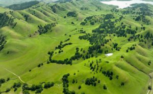
View from Morgan Territory Regional Preserve of Round Valley Regional Preserve and Los Vaqueros watershed. Photo by Cooper Ogden
When did you start working with Save Mount Diablo?
My dad was a Board member when I was growing up, so that was my first exposure to Save Mount Diablo. We were always doing events, going to Moonlight on the Mountain.
I remember helping Art Bonwell put batteries in the table lanterns, I was probably six or seven.
My first photography project was a photo book that was exhibited at the silent auction at Moonlight on the Mountain. I was seven when I did this, it was a book of views of the mountain and various things like that.
In official terms though, my first drone project was around 2013 or ‘14. That’s when I started doing drone work and videography. It was a property on Marsh Creek Road.
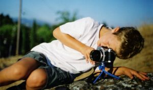
Photo courtesy of Cooper Ogden
What photography do you do in addition to your work with Save Mount Diablo?
I do a lot of photography for fun with the drone in general. Since moving to San Francisco, I’ve spent time doing a lot of film photography while doing urban hikes exploring what is a new part of the Bay Area to me.
It’s been fun to take my interest in landscape photography and translate that to a much more urban environment.
How do you spend your time beyond photography?
I do a lot of walking and hiking. That’s kind of my bread and butter these days. A couple weeks ago, I did a cross-town hike of San Francisco where I started down by the Ferry Building and made my way out 10 miles across the city to the ocean.
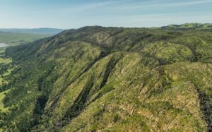
Morgan Territory Regional Preserve. Photo by Cooper Ogden
What does Mount Diablo mean to you?
It means a lot just based on the importance that it’s had throughout my life, being great exposure to nature at a really base level.
Having grown up with my dad on the Board of Save Mount Diablo, Mount Diablo and the surrounding parks have always been a part of my life.
To me Mount Diablo means home.
Diablo Range Revealed
Through Cooper’s work, it’s possible to see the Diablo Range like never before as it continues its recovery from the 2020 SCU Lighting Complex wildfires.
His photos and videos show the incredible changes that these landscapes have undergone over the last three years. You can see some of his videography in our first Diablo Range Revealed video.
We’ll be sharing more of his work through our Diablo Range Revealed project, a series of videos and articles documenting the Diablo Range, with a particular focus on the aftermath of the 2020 fires.
Stay tuned to see parts of the Diablo Range like never before as it continues to regrow and recover from the fires.
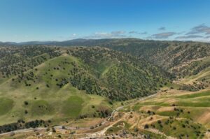
Tesla Park in May 2023. Photo by Cooper Ogden
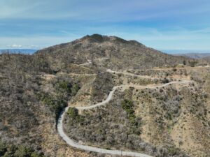
Mount Hamilton after the 2020 wildfires. Photo by Cooper Ogden
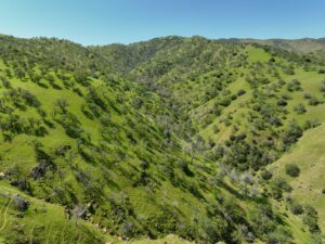
Del Puerto Canyon in spring 2023. Photo by Cooper Ogden
Photos by Cooper Ogden. Top photo: Morgan Territory and Round Valley Regional Preserves

