Distance: 10.5 miles
Elevation gain: 2,500 feet
Difficulty: Advanced
Hiking time: Five to 10 hours on foot, two to three hours by bike
Trail surface: Unpaved trails and bike-legal single-track trail
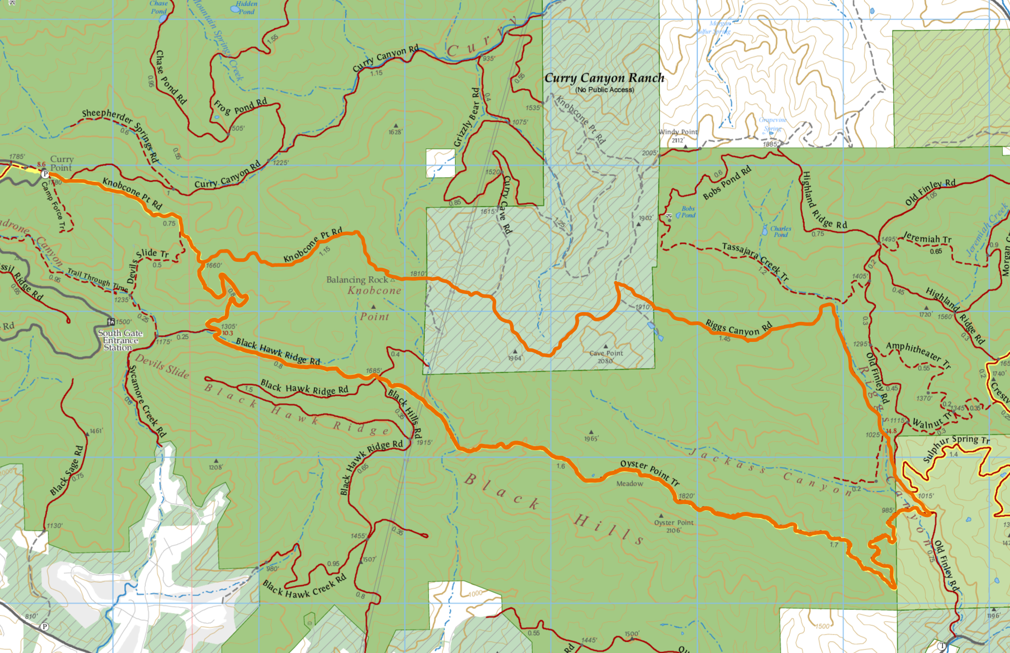
Best season: Early summer once dry
Hours: 8 AM to sunset
Managing agency: California State Parks
Trailhead location: Curry Point parking lot
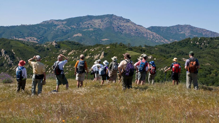
This route features Save Mount Diablo’s newly opened Knobcone Point Trail through its Curry Canyon Ranch property and is accessible both on foot and by mountain bike.
This advanced route includes rugged terrain, with considerably steep sections on its eastern side.
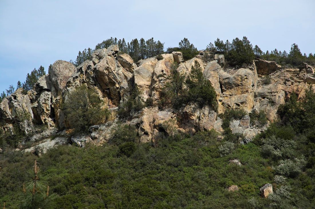
Rocky cliffs in the Knobcone Point area of Save Mount Diablo’s Curry Canyon Ranch. Photo by Scott Hein
It’s recommended to traverse the route first through Knobcone Point because of some of the steep terrain found heading down and into Riggs Canyon.
This section contains about 1000 feet of downhill elevation change in a short distance. An abundance of caution and respect for the mountain is key to a safe trip.
Some of the terrain is very exposed, so bring plenty of water and sunscreen.
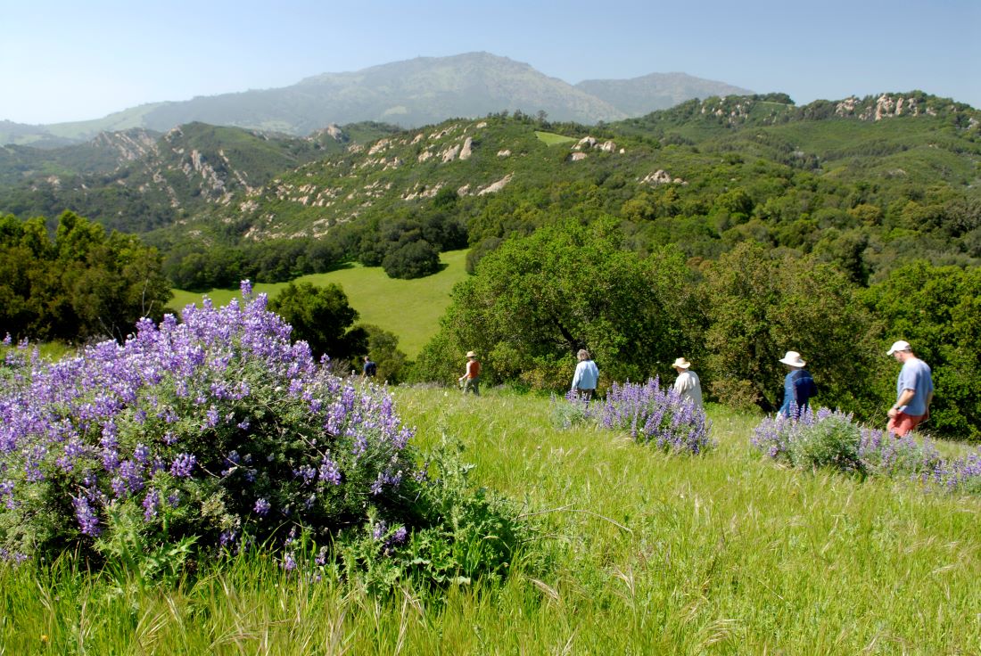
Photo by Scott Hein
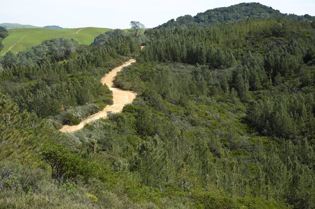
Shade is abundant in the southern part of the loop in the narrow, technical section along the Oyster Point Trail and Blackhawk Ridge.
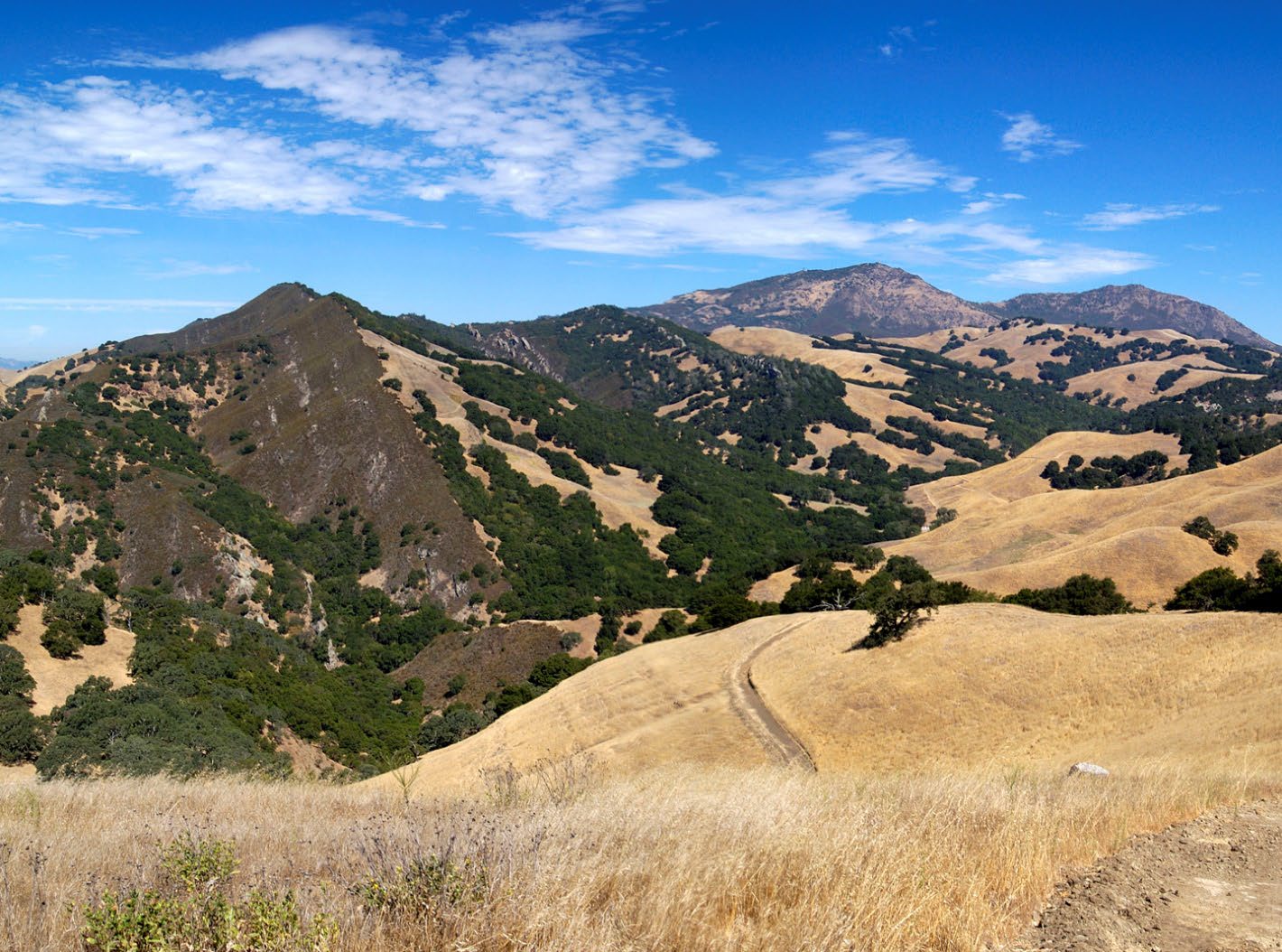
Oyster Point, Jackass Canyon, and Riggs Canyon. Photo by Scott Hein
This shade should make for a more pleasant climb back to Curry Point than if the loop was taken in a counterclockwise fashion.
We’ve previously dubbed the Oyster Point Trail “the best legal single track in Contra Costa County” in a post about the best mountain biking you can do on Mount Diablo.
However, expect hazards like poison oak and ticks adjacent to this uncommon legal single track trail after our wet winter.
Many native and endemic species hide out or can even be found in the wide open along these paths.
Showy clarkias, monkeyflowers, mariposa lilies, and even the endangered Mount Diablo manzanita— you just have to keep an eye out.
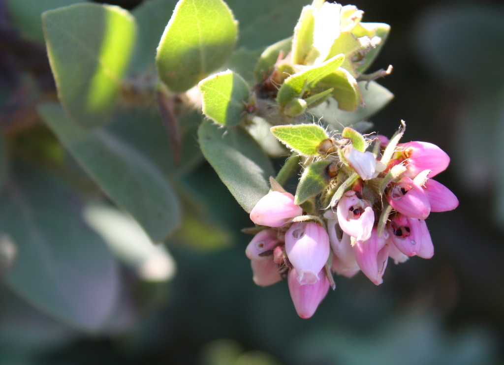
Mount Diablo manzanitas have pink, urn-shaped flowers and hairy leaves. Photo by Scott Loarie
These areas offer some of the more remote spaces in Mount Diablo State Park, and for those looking to really get out there, they can be a great escape.
However, because this route is advanced and more remote (you may see few people or no one at all), always be prepared for what’s around the bend.
Keep an eye out for wildlife, fallen trees, landslides, unexpected people, and so on. This area is a very remote place that deserves respect.
The Knobcone Point Road trail segment travels along the ridgeline from Knobcone Point to Riggs Canyon. Photo by Scott Hein
We hope you enjoy this hike, please check out our new sixth edition of our regional trail map to find more great places to hike close to home.

