Distance: 12.3 miles
Elevation gain: 4,229 feet
Difficulty: Strenuous
Hiking time: Eight to 12 hours
Trail surface: Unpaved trails
Best season: Winter and spring
Hours: February 1 to March 8: 8 AM to 6 PM, March 9 to May 8: 8 AM to 8 PM, May 9 to November 1: 8 AM to 9 PM, November 2 to January 31: 8 AM to 5 PM
Managing agency: East Bay Regional Park District
Trailhead location: Lichen Bark picnic area, Del Valle Regional Park
Fees: Trail permit fee of $2/person/year, $4/person/year by mail
Dogs: Dogs are allowed during the daytime only. Fee paid at Sunol or Del Valle entry point.
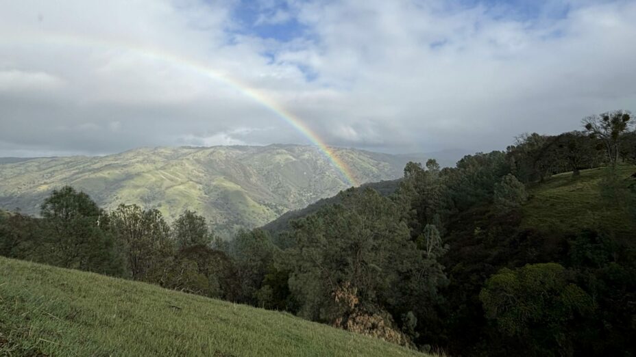
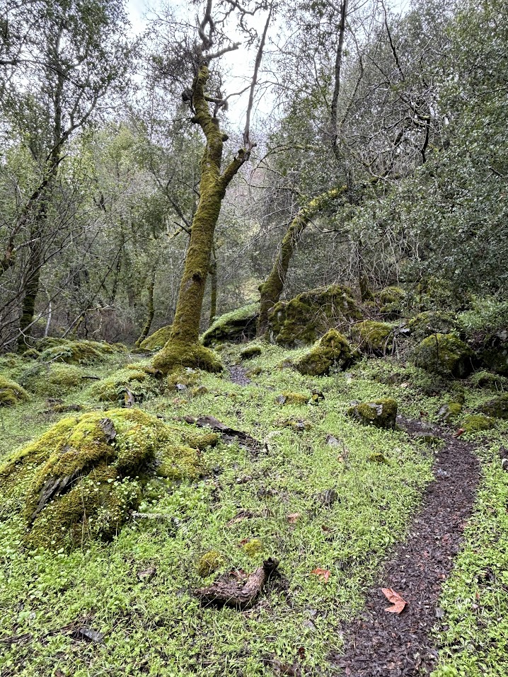
Southeast of Mount Diablo, the Ohlone Wilderness Regional Preserve has much to offer. Here you can escape the nearby bustle of the Bay Area and connect with the natural beauty California holds in abundance.
Ohlone Wilderness. Photo by Scott Hein
California’s greatest natural features include the waterfalls in Yosemite National Park, Burney Falls, and Alamere Falls.
But if you don’t want to stray too far from the Bay Area and are willing to put in some hefty legwork, Murietta Falls might be the perfect destination.
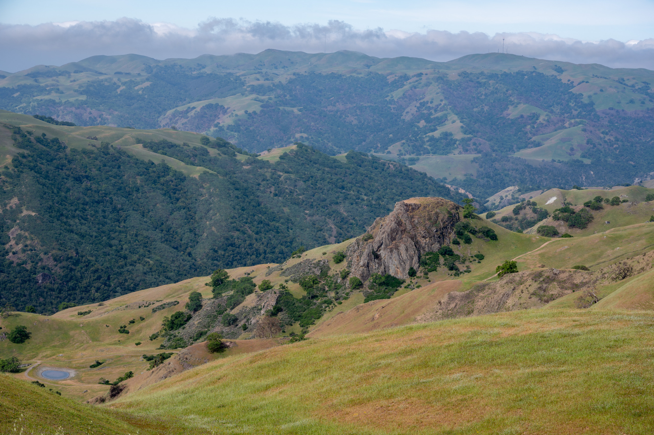
Ohlone Wilderness Regional Preserve. Photo by Scott Hein
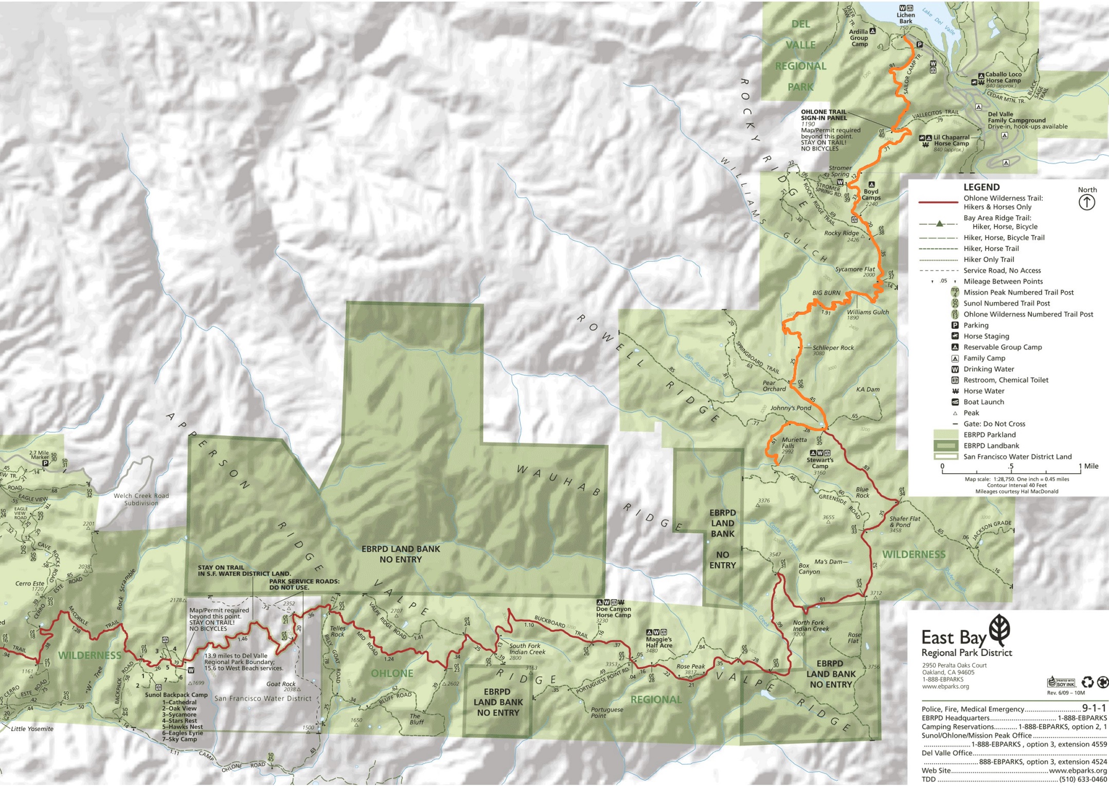
There are a few ways to reach these falls. The easiest way to get to them is from the southern edge of Del Valle Regional Park at the lot near the Lichen Bark picnic area.
The path there is quite a journey at a little more than 12 miles with considerable elevation gains and losses. Special permits are also needed, so planning ahead, starting early, and bringing plenty of resources is highly recommended.
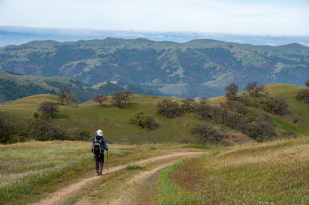
Ohlone Wilderness. Photo by Samantha Kading
This out-and-back hike is akin in difficulty to summiting Mount Diablo, but much more remote. After parking, work your way over to Lichen Bark picnic area at the far end of the parking lot and look for the Ohlone Wilderness Trail sign.
You’ll have some great views of the reservoir on the way up the trail. After a mile moving south, you’ll come to the sign-in board for Ohlone Wilderness Trail. Don’t forget to sign in and out. You’re now entering the backcountry.
There are more ascents and descents from ridges as you pass the Stromer Spring intersection and past Boyd Camp.
Then there’s an Ohlone Trail marker, #38, that notes the backcountry overlook. From there, continue to Sycamore Flat, then down the steep descent into Williams Gulch.
AllTrails has some specific instructions for crossing the creek that runs in the gulch:
Don’t try to cross at the first obvious area: that trail dead-ends in the woods. Take the narrow single-track up to the right, and stay on the trail till it returns to the creek. Crossing will be dicey in high water—be very careful as you look for rocks to cross.
From here, it’s a two-mile, 1,400-foot climb up Big Burn to Schlieper Rock. Heading down from there, keep left at the OT36 marker, turn right at the OT35 marker, and then left at the junction about a quarter mile thereafter.
It’s about a half mile to the falls after that last turn, but a treacherous bit. Be careful in this section as you cross the creek. You’ll then see a narrow, rocky trail tracking a stony gorge that leads to the falls.
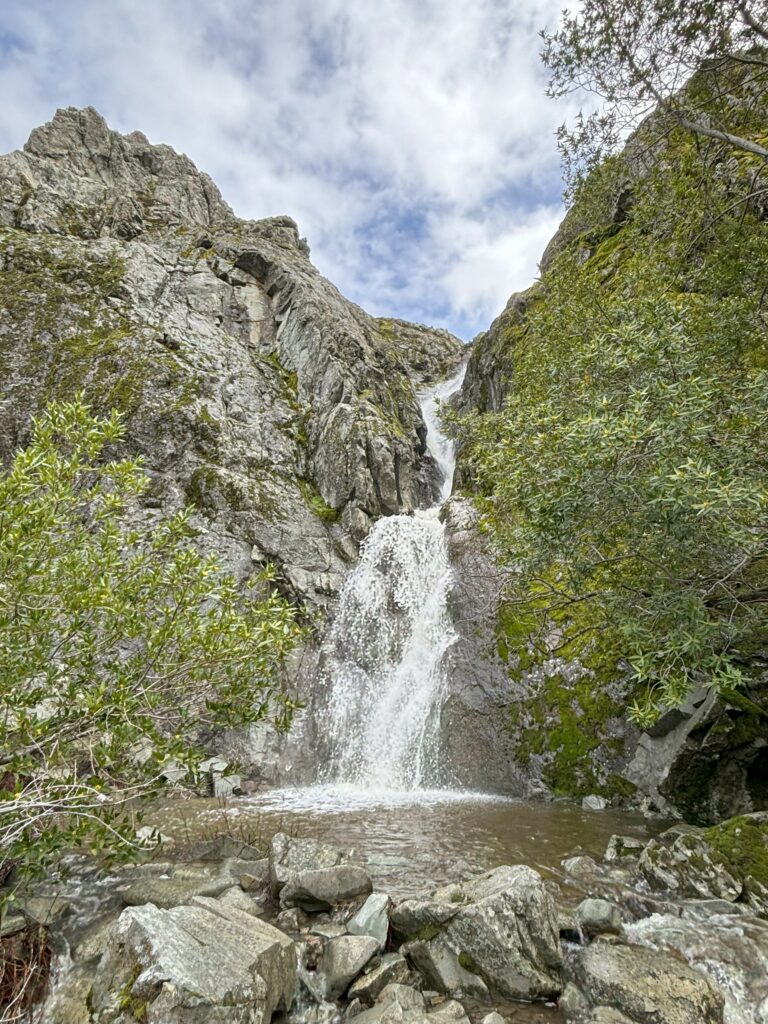
Murietta Falls. Photo by Samantha Kading
The falls are just the halfway point, so take a good breather, grab a snack, and begin working your way back to the parking lot by retracing your steps.
We hope you enjoy this hike; please check out our new sixth edition of the regional trail map to find more great places to hike!

