Making the First Map
Save Mount Diablo released the first Mount Diablo regional trail map in 2007, with the goal of highlighting the vast outdoor recreation opportunities in the area.
The first edition was released in 2007.
The process behind the first map was “equal parts science, art, sweat, and love.”
Though other maps have beautifully detailed the numerous parks in the East Bay before this one, Save Mount Diablo’s map was the first to present them in a unified design, with cutting edge cartographic techniques.
John Kelly, a volunteer cartographer, devoted thousands of hours into making the map amazingly detailed, yet easy to use.
He scanned dozens of other maps to glean information, and corrected the map in minute detail using 400 aerial photos.
He labored over decisions from label and icon design, to color choices, to identifying gaps in information for others to provide.
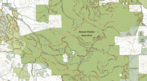
Our volunteer map committee walked hundreds of miles with GPS units, working for two years to document all of Diablo’s parks and trails for the first time in the most accurate Diablo map ever created.
Utilizing this vast database of information collected via GPS surveys, Save Mount Diablo worked to incorporate hundreds of layers into the first map.
Map committee members tirelessly verified features, each person providing unique expertise in areas of history, first-hand field knowledge, and the harnessing of cartographic and design software.
Drafts of the map were sent to various agencies for their suggestions and corrections, including Contra Costa Water District, East Bay Regional Park District, Mount Diablo State Park, the Mount Diablo Interpretative Association, the City of Walnut Creek Open Space system, and the Walnut Creek Open Space Foundation.
What Else Makes This Map Special?
This detailed map was made to accompany people on their journeys through our local parks and open spaces.
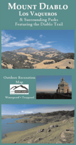
Our regional trail map is double-sided—two maps in one that feature hundreds of miles of trails to enjoy on and around Mount Diablo and the Los Vaqueros Reservoir (Mount Diablo State Park alone has over 160 miles of trails).
From the very first edition, the map was also full color, waterproof, and tearproof. It has always been intended to be a useful recreational map that could accompany people on their journeys through Mount Diablo’s most rugged trails and open spaces.
The map is currently available in digital format on our website and on the Avenza app.
What this means is that you can download the map ahead of time. As you visit Diablo’s parks, your location is shown in the Avenza app so that you always know where you are and can explore more easily.
This map is not only an important educational tool, it also inspires people to protect and enjoy our cherished open spaces.
Save Mount Diablo wanted the map to celebrate protected lands and to highlight private land still in need of preservation.
On the map, the public can see both the accomplishments of the coalition of agencies and groups working in the East Bay, and the work that lies ahead.
The map is a tremendous resource for all types of recreational users. They are among our biggest allies, and we know that getting people onto the land will increase their interest in conservation.
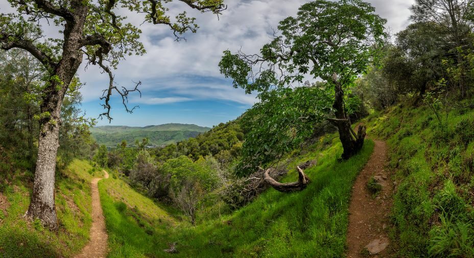
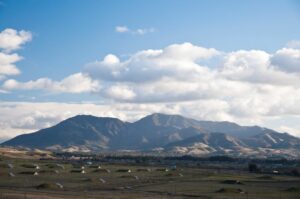
The Diablo Trail
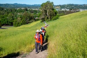
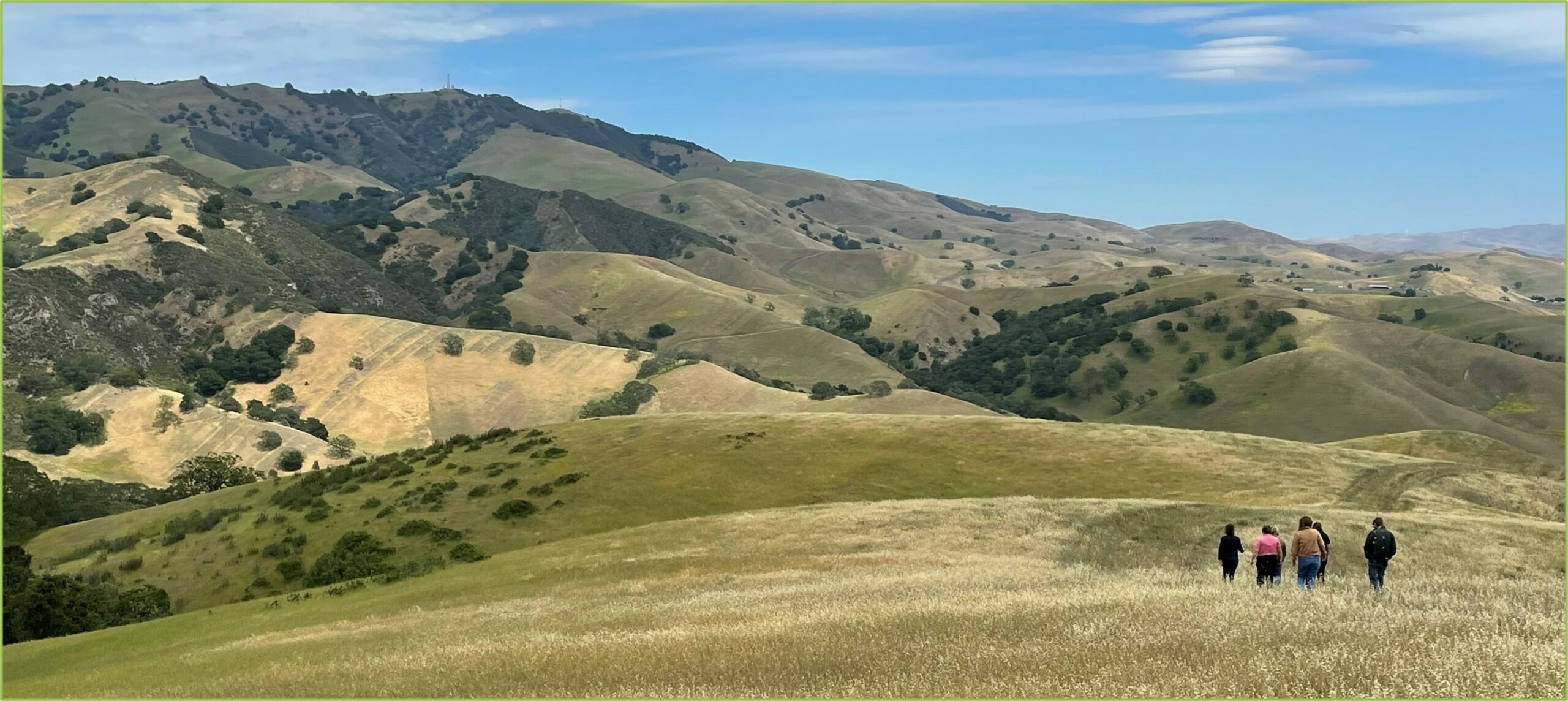
Hikers enjoy the Walnut Creek Open Space trails. Photo by Scott Hein
The first edition of this trail map showcased the 31-mile Diablo Trail for the very first time.
It stretches from Walnut Creek to Livermore, through six different open spaces—Shell Ridge Open Space, Diablo Foothills Regional Park, Mount Diablo State Park, Morgan Territory Regional Preserve, the Los Vaqueros watershed, and Round Valley Regional Preserve.
This trail would not be possible without the decades of conservation work and cooperation from Save Mount Diablo and our partners.
One day we hope to extend the trail into a 60-mile grand loop through the Diablo region. As of now, most of the land necessary to complete the grand loop has been protected, but some parts are on land that is not yet publicly accessible.
Protected versus Accessible
Parts of the former Concord Naval Weapons Station will become a publicly accessible regional park in the future. Photo by Scott Hein
Areas on the map include shading and labels that indicate “no public access.” It may take years to assemble parcels for a park and then more time for cleanup, and construction of public facilities and trails, before access is allowed.
Some of these areas will be open in the future, whereas others are protected for sensitive resources or by conservation easements that do not include public access.
We feel it is important to show all of what is protected as well as what is accessible.
The map also indicates potential. For example, the former Concord Naval Weapons Station is owned by the public. Part has become Thurgood Marshall Regional Park.
The remainder is undergoing a reuse planning process that will decide which areas are protected and which might be developed.
The map easily demonstrates the short distances from the former weapons station to Clayton Open Space and to Black Diamond Mines Regional Preserve.
New Edition Released This Summer
This summer we were proud to announce the official release of the sixth edition of our Mount Diablo regional trail map.
Produced by Save Mount Diablo and sponsored by Visit Concord, this groundbreaking map showcases the trails and topography of Mount Diablo, Los Vaqueros, and surrounding parks in detail.
The map details 338,000 acres of land throughout the Diablo Region—over 120,000 acres of which are now protected, thanks to decades of conservation work.
Finley Road Ranch, protected by the East Bay Regional Park District in April 2023. Photo by Michael Reeves
Since the creation of the first edition, Save Mount Diablo has periodically created new editions to accurately reflect the trails and impacts of conservation work in the East Bay.
The latest edition of the Mount Diablo regional trail map includes lands recently protected by Save Mount Diablo and its partners, such as Finley Road Ranch.

