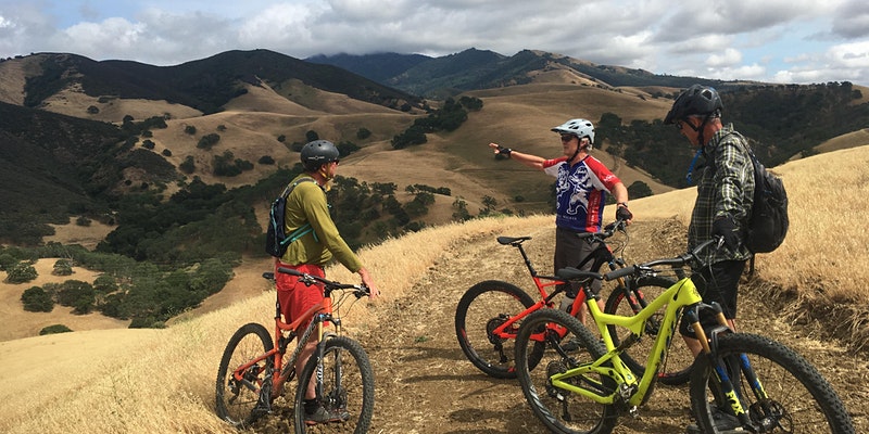
Odds are that if you have ever driven up to the top of Mount Diablo, you’ve passed a few cyclists along the way. The mountain shoots up like a monolith, and with an asphalt road leading straight to the top, it’s a terrific goal for cyclists.
However, the mountain is just as good for mountain bikes as it is for road bikes. With lots of trails and many hills, everyone from beginners to experts alike can find a trail that suits their difficulty. Additionally, the mountain is suitable for all types of mountain bikes, from fully rigid bikes to full suspensions, and more. Here are some of our favorite trails.
Hit the trails and go on FREE guided bike tours across some of our properties with our Discover Diablo series!
Fire Roads on Mount Diablo
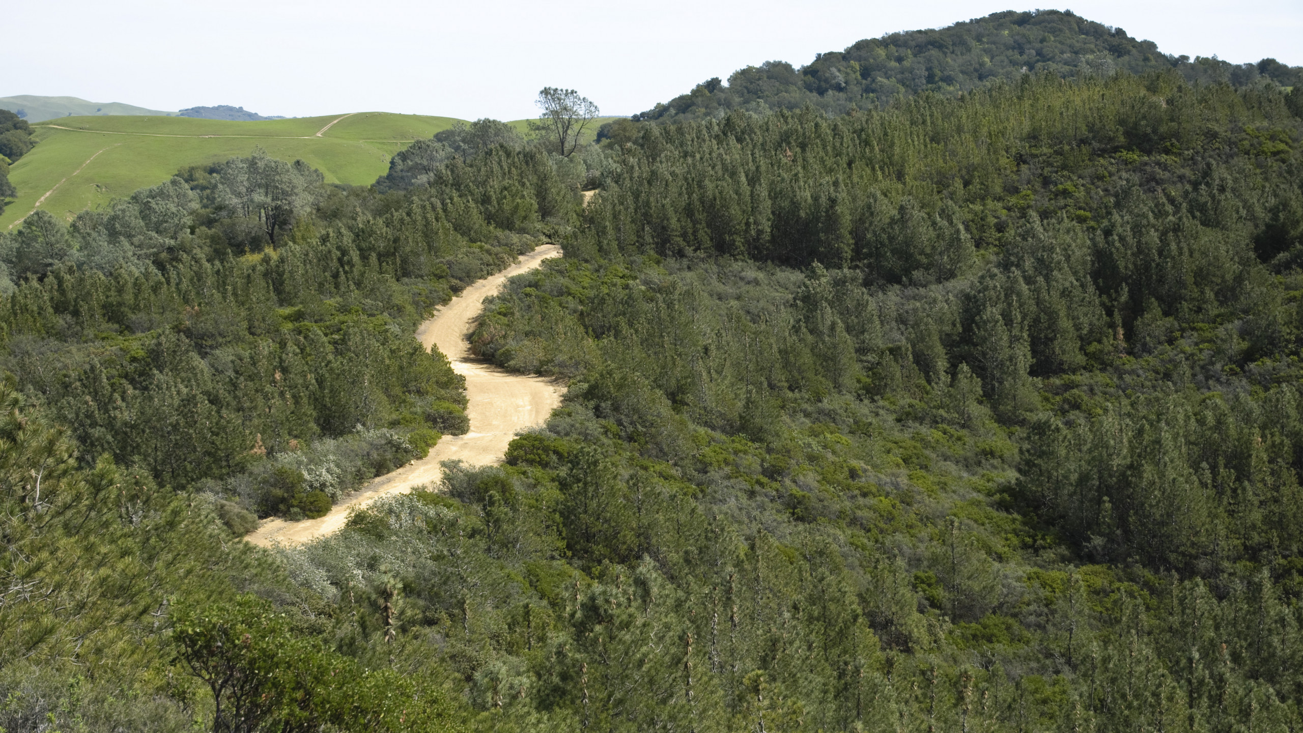
Photo by Scott Hein
Most of the mountain biking on Mount Diablo is available only on fire roads. However, as this post will discuss, there are a few single tracks available to bikes. Throughout most of the year, traction on these trails is great. During the summer months, however, they can become dry and loose. Here are some of our favorite fire roads:
1. Mitchell Canyon Fire Road
Difficulty: Easy to Strenuous
There may not be another trail on Mount Diablo that suits such a large range of skill levels besides the Mitchell Canyon Fire Road. It can be a nice cruiser ride as well as a test piece. Here’s why:
The first two miles of this trail features a gradual incline. After about two miles, there will be some picnic tables on the left side, which means either one of two things: it’s time to turn around or your warmup is over. For those looking for an easier ride or just starting out, getting to these picnic tables offers a nice objective. Going down is quite fun because it’s a steady downhill, but be cautious of hikers: this trail is very popular, and there are lots of blind turns.
If you’re looking for a challenge, the trail becomes dramatically steeper after the tables. On top of that, the trail can be quite loose, and it is easy to lose traction if you are not careful (watch your speed and stay in control while turning around the bends going downhill). From these picnic tables, the climbing doesn’t stop. You could go all the way to the top of the mountain. However, there are quite a few places to turn around. The first major landmark you’ll hit is Deer Flats, which is about 2,000 feet in elevation.
If you are still looking for more, you can turn right and go up Deer Flats Road, which will lead you to Juniper and eventually the summit. Or, you can continue straight and make a loop by going down Meridian Ridge Road.
View the MTB Project info on Mitchell Canyon Fire Road
Getting there:
Park at the Mitchell Canyon Visitor Center (there is a $6 fee with exact change or a check required).
2. Briones to Mount Diablo Trail
Difficulty: Easy to Moderate
This trail starts quite a bit away from the mountain. That being said, you’ll go up and down the foothills of Shell Ridge as you gain elevation to the base of the mountain. This trail is fantastic, with lots of options. There are many trails to break off of and make into a loop, or you can do it as a long out and back (the trail is about six miles long). Toward the end of this trail, you’ll be at the start of Wall Point Road, another one of our favorite trails.
If you decide to bike this trail during the hotter summer months, you should go early or late. The hills are quite exposed and can heat up fast.
View the MTB Project info on Briones to Mount Diablo Trail
Getting there:
Park at Shell Ridge Open Space.
3. Stage Road
Difficulty: Easy to Moderate
This is a fantastic trail for beginner mountain bikers looking to step up their game. Though the route does have some moderate hills to climb, there are some mild technical sections. During the beginning, after you climb the first hill, you will have to bike down a rocky sandstone section. Many trails on Mount Diablo are just dirt, so this is a great trail to introduce yourself to bumpier terrain. This trail will give you a taste of what Wall Point Road will be like (another one of our favorites).
Also, this trail is jaw-droppingly stunning, and arguable the quintessential trail of Pine Canyon. You will pass by the sandstone cliffs of Pine Canyon where the elusive peregrine falcons live. Plus you are biking in a canyon, so it is cooler in the summer months. If you go in the spring or wintertime, there are some creek crossings you’ll have to bike through (please don’t give a hiker an unexpected shower; wait until the creek is clear before crossing).
View the MTB Project info on Stage Road
Getting there:
Park at the Castle Rock Regional Park trailhead.
4. BBQ Terrace Road
Difficulty: Moderate to Strenuous
At the end of Stage Road, you’ll find that you are left with different options of trails to take. One of these trails is BBQ Terrace Road. This trail is a great trainer and test piece. It starts with a gradual incline and gets steeper the further up you go. Overall, from the start of the trail, you’ll climb a bit over 1,000 feet. If you have a goal to bike all the way to the summit, this is a great trail to train on.
View the MTB Project info on BBQ Terrace Road
Getting there:
Park at Castle Rock Regional Park, then go on Stage Road.
5. Wall Point Road
Difficulty: Strenuous
In terms of fire roads, this is one of the most beautiful one you can find on Mount Diablo. You’ll have great views of the mountain to your left side, and the higher up you climb, the better the views of Pine Canyon. To your right, you’ll have great views of Las Trampas. This trail will lead you all the way to Rock City, one of the main attractions of Mount Diablo.
Although most of the fire trails on Mount Diablo you can ride with a hardtail or even a fully rigid bike, you’ll be thankful for the suspension your bike has here. This trail isn’t very technical in terms of tight turns and jumps, but there are some steep sections of rigid sandstone that you will have to ride over. Going up on these sections isn’t particularly memorable, but going downhill can be a bumpy ride. Furthermore, expect there to be a lot of uphill climbing on this road. Bring plenty of water, but you can refill at Rock City.
View the MTB Project info on Wall Point Road
Getting there:
Macedo Ranch: From here, you can start on Wall Point Trail directly from the trailhead.
Pine Canyon: As soon as you can, get to the Briones to Mt. Diablo Trail.
6. Burma Road
Difficulty: Strenuous
Riding down this trail has been described as “like taking an elevator down the mountain—only a lot more fun.” This trail is generally only ridden downhill. To call this trail steep could be a bit of an understatement. You’ll drop nearly 1,400 feet in two miles. Be cautious: the last section is very steep, so you should be experienced before taking this trail downhill. If you can bike this whole trail uphill, we applaud you.
View the MTB Project info on Burma Road
Getting there:
Be prepared for a lot of miles for this climb. This trail may be a bit hard to find if you have never been before. Castle Rock Regional Park is the most straightforward parking lot, and this is where you will end. A good rule of thumb to get to the top of this trail is to get to Juniper Campground. This being the case, many people will choose to bike Northgate Road up. You can think of this adventure as like a roller coaster: a long gradual climb for a steep downhill. From Juniper Road, take Deer Flats Road to Burma Road. Be careful to not accidentally go down too soon. You’ll find yourself at Mitchell Canyon instead of Castle Rock!
Single Track Trails on Mount Diablo
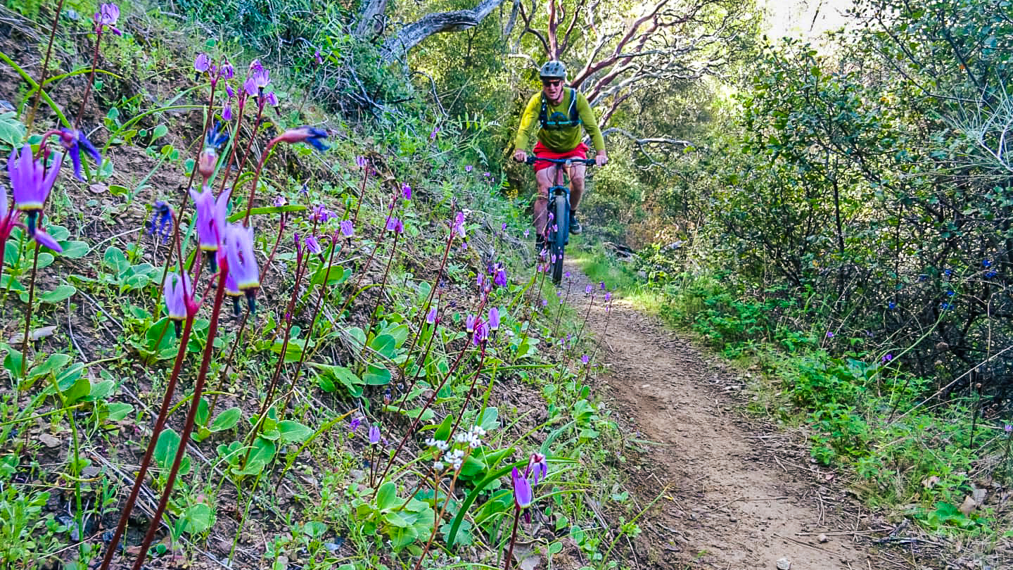
Photo by Sean Burke: Executive Director Ted Clement cruising down a single track legally at Henry Coe State Park
If you’ve spent some time biking within Mount Diablo State Park, you’ve probably noticed already: most single tracks don’t allow mountain bikes. Though some bikers got frustrated by this, the rule is understandable because there are many blind turns and there’s a lack of space on the trail.
In fact, I’ve been hiking up the George Cardinet Back Creek Trail and just barely escaped a head-on collision with an illegal mountain bike by leaping into the chaparral.
With that all said, there is still the rare single track you can find on Mount Diablo that allows mountain bikes.
Note: Because single-track trails are more technical, they will be rated by technical difficulty rather than physical difficulty.
7. Buckeye Trail
Difficulty Rating: Intermediate
The Buckeye Trail is carved into the west side of the mountain and offers great views of the East Bay and Pine Canyon all the way down. It’s a gradual downhill, and there are only a few steep places. For the most part, it feels like a flow trail. For the most part, you will go down open grasslands and cross a few canyons. When it comes to single tracks on Mount Diablo, this is a great trail to start on.
View the MTB Project info on Buckeye Trail
Getting there:
You can ride this trail in both directions. However, going down will have more flow. Park at Castle Rock; go up to Stage Road to Burma Road. The turnoff for Buckeye Trail will be just before North Gate Road. The trail will bring you back to Stage Road.
8. Oyster Point Trail
Difficulty Rating: Black Diamond/Difficult
Oyster Point Trail has been unofficially dubbed “The best legal single track in Contra Costa County.” It’s a hidden gem on Mount Diablo and one that requires quite a bit of work to get out to. Because this trail is more isolated, it is less used, so you should be prepared for unexpected trail conditions. In the winter months, the trail is stomped down by cows. Also, there is poison oak growing on both sides of the trail. Finally, because it is isolated, this trail would be a bad place to pop a tire and not have a spare tube with you.
However, with all that said, this trail is excellent and well worth the trip out. We recommend you ride this trail towards Finley Road rather than from Finley Road up. This way, you’ll enjoy the nice flowy single track.
View the MTB Project info on Oyster Point Trail
Getting there:
There is no straightforward way to tackle this as a loop. You should bring a map with you. Be prepared to take two cars and a friend and do this as a point to point, or be prepared to ride a lot of miles.
As a point to point, you’ll want to have one car at the end of Finley Road, and the other car at the trailhead for Curry Canyon Road/Knobcone Point Road (here are the coordinates). You’ll want to head towards Knobcone Point, and then take a right onto Black Hawk Ridge Road, another fire road. Eventually, there will be a split to Sycamore Creek Road, heading right. Make sure you stay on Black Hawk Ridge Road on your left. You’ll then run into a trail junction, and you’ll see Oyster Point Trail.
If you’re going solo, you can try parking at Finley Road, and doing this as an out and back.
9. North Peak Trail
Difficulty: Black Diamond/Difficult
Mount Diablo is famous for its expansive views of northern California, and this bike-friendly trail will give you the best views. As a hiker, we’d recommend circumnavigating the mountain by walking the Mary Bowerman Trail.
However, as a mountain biker, there is a single-track trail that takes you down from the top of the mountain. This is the North Peak Trail. This multi-use trail is located near the top of Mount Diablo, and the single-track strip goes from the Devil’s Elbow to Prospector’s Gap.
The name of the trial can be a bit misleading. This single-track segment is located on the main peak of Diablo, not North Peak. Going down, you’ll have wid open views of the mountain’s west side. You can see Morgan Territory Regional Preserve, Round Valley Regional Preserve, the Sierra Nevada, and much more.
Although the view is quite stunning, you should keep your eyes on the trail. This is a difficult trail, and it has a suggested black diamond rating. There are some steep drops off some rocks, hairpin turns, and loose dirt.
Because of the trail’s difficulty, we’d also recommend going downhill rather than uphill. The single track is, however, short compared to the rest of the trails you would be doing. The single-track portion is about a mile long.
View the MTB Project info on North Peak Trail
Getting there:
For those considering going down this trail, getting there is the crux. You’ll have to bike up to the summit, which can be done from the main road, Mitchell Canyon, Burma Road, or a number of other places. Mitchell Canyon is the best spot, because the most straightforward way to get down from this trail is to take the Prospectors Gap fire road down to Deer Flats and then Mitchell Canyon.
The “V” option: If you want to try out the single track with the best view in the Bay Area but are not up to riding to the top from the bottom, you can complete this trail as a “V.” In other words, you can drive up to the Devil’s Elbow, park, and ride the trail down and up.
Bonus
The Mountain Biking Hub of the East Bay Area: Crockett Hills Regional Park
Difficulty: Easy to Strenuous/Difficult
As terrific as Mount Diablo is for mountain biking, many may agree that it is generally more of a place to ride in a cross-country style. In other words, stamina and endurance are more important than technical skills.
For those looking for more flowy downhill trails and single track, Crockett Hills Regional Park is the place to go. This park has flow trails, which are trails created for the use of mountain bikes. For bikers, it’s nonstop fun from the top of the trail to the bottom. There are bermed turns (which aren’t generally found on Mount Diablo) and bumps where you can practice your jumps or pumping. Two of the park’s most famous trails are Sugar City Trail and Tree Frog Loop. Try them out yourself.

