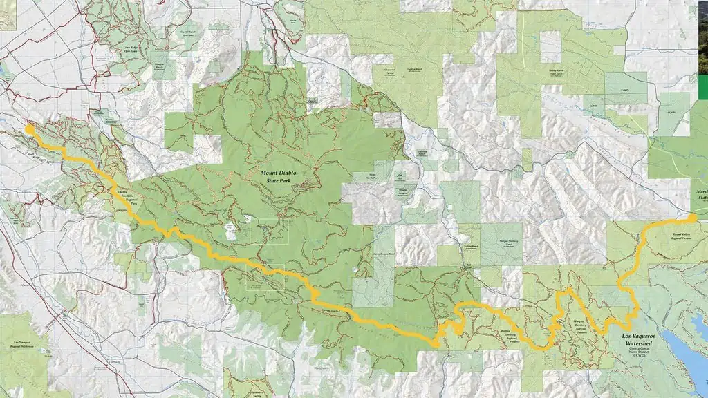
The 31-mile multi-use Diablo Trail perfectly showcases not only the stunning Diablo landscape but also the regional cooperation that allowed for preserved lands across Mount Diablo from Walnut Creek to Brentwood and Livermore.
The Diablo Trail winds through six different open spaces—Shell Ridge Open Space, Diablo Foothills Regional Park, Mount Diablo State Park, Morgan Territory Regional Preserve, the Los Vaqueros watershed, and Round Valley Regional Preserve. It showcases the teamwork with our partners in protecting these majestic lands around Mount Diablo.
It is our hope that one day the 31-mile trail can extend around the parks in a 60- to 70-mile Grand Loop Trail, encompassing protected lands within. Most of the route for the Grand Loop has already been protected; some sections of it are on public lands that are not yet open to the public.
Here’s a map showing the route of the Diablo Trail as it traverses six different open spaces:
Explore the Diablo Trail and many other trails in our region with Save Mount Diablo’s comprehensive regional trail map!

