
Below you’ll find a list of many publicly accessible areas up and down the Diablo Range suitable for this year’s BioBlitz event. Click on the plus sign in each dropdown menu to learn more.
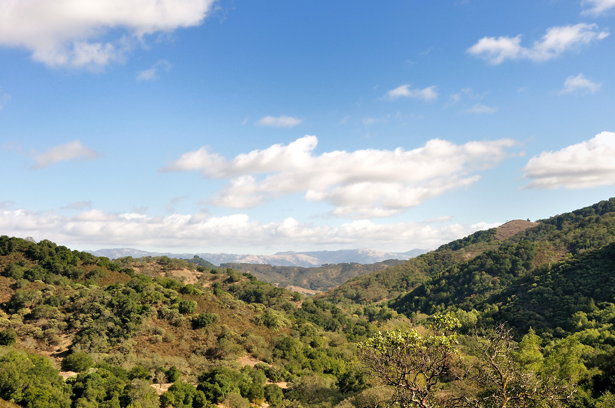
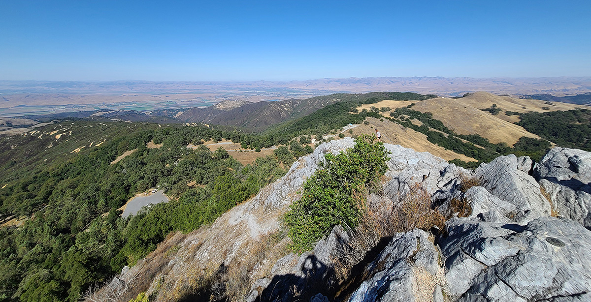
Clear Creek Management Area
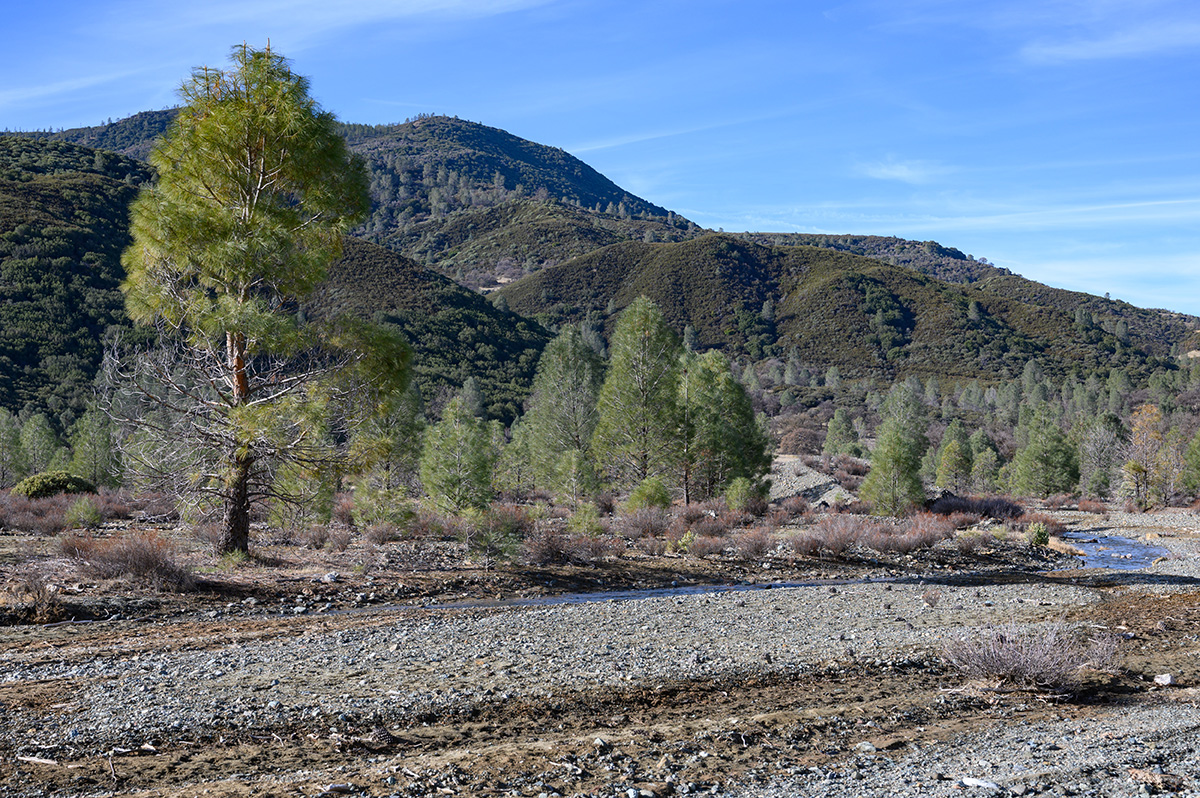
Clear Creek Management Area. Photo by Scott Hein
More information from BLM.gov: Clear Creek Management Area | Bureau of Land Management
Where: Clear Creek Road, Paicines, CA 95043
GPS coordinates: 36.36143419598481, -120.76921287410445
Size: 75,000 acres (63,000 acres of public lands)
Elevation range: 1,830 feet at Pine Canyon to 5,241 feet on San Benito Mountain
Description: The Clear Creek Management Area is characterized by rugged topography; a Mediterranean climate punctuated by cool, wet winters, and hot, dry summers; great views of the Central Valley and the Sierras; deep forests; and diverse flora and fauna.
San Benito Mountain is the highest peak in the Diablo Range, and its summit provides exquisite views of the Pinnacles to the west and falls away to the Panoche Valley, Central Valley, and Sierra to the east.
- Activities: hunting, camping, hobby gem and mineral collecting, mountain biking, horseback riding, hiking, backpacking, trail running, photography, painting, meditation, and sightseeing.
- Hobby gem and mineral collecting: Here is one of the most highly mineralized areas in California, with over 150 semi-precious minerals and gemstones including serpentine, jadeite, cinnabar, tremolite, topazite, neptunite, and the extremely rare California state gem, benitoite.
- Camping: Oak Flat and Jade Mill (both have picnic tables, shade structures, fire rings, and pit toilets).
- Permits/fees: Yes, multiple permits are needed.
- Serpentine Area of Critical Environmental Concern permit: free, needed to access the Serpentine ACEC for the duration of one day.
- Clear Creek vehicle permit: required to enter the Clear Creek Management Area, including Condon Peak campground and trailhead. $5 per vehicle, valid for seven days from the date of entry. A permit must be displayed.
- Condon Peak all-terrain vehicle permit: required for every ATV or utility terrain vehicle. $10 per ATV/UTV, valid for seven days from the date of entry for drivers age 16 and older.
Joaquin Rocks
More information from Summit Post: Joaquin Rocks: Climbing, Hiking, and Mountaineering
Where: southern portion of the Clear Creek Management Area (BLM)
GPS coordinates: 36.321349221574174, -120.44800291255605
Elevation range: 3,700 to 4,000 feet
Description: This magnificent corner of the range consists of primarily three large sandstone outcroppings that sit atop Joaquin Ridge in the BLM’s Clear Creek Management Area of the Diablo Range and is the epitome of solitude.
Though visible from busy parts of I-5 in Fresno County, the rocks are rarely visited because of the remoteness of their location. High clearance and 4-wheel drive is required to reach the trailhead.
The rocks are then accessed by a 4.5 mile hike along a fire road that runs along Joaquin Ridge and the spine of the Diablo Range, followed by a final 0.5-mile single-track trail leading to the actual rocks.
There are three main rocks, which all reach about 200 feet in height. From west to east, they are La Piedra del Oeste (the Stone of the West) at 4,003 feet, La Centinela (the Sentinel) at 4,012 feet, and La Catedral Grande (the Large Cathedral) at 3,980 feet.
Activities: Hiking, trail running, climbing (mostly scrambles/slabs), bird watching, botanizing, photography, painting, meditation, and wildlife viewing.
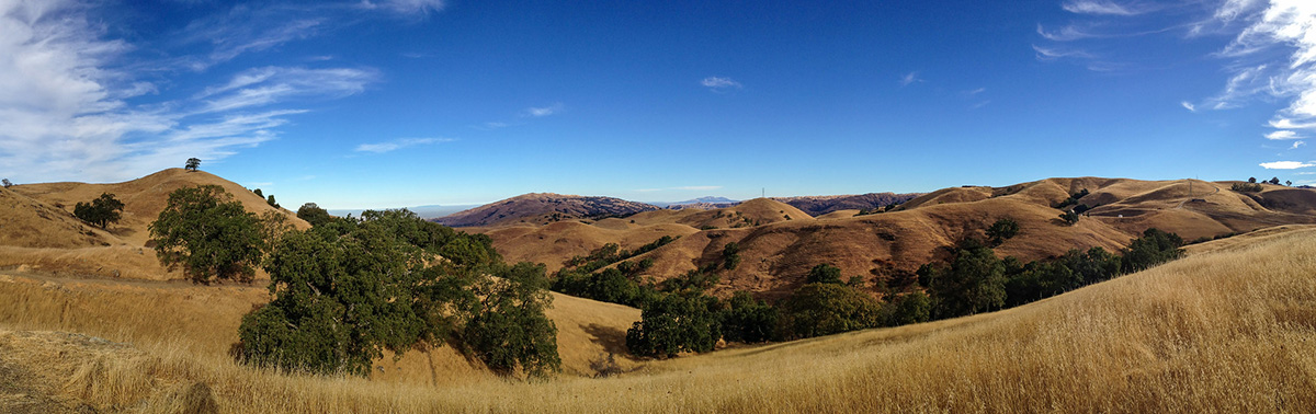
Laguna Mountain
Laguna Mountain. Photo by Scott Hein
More information from BLM.gov: Laguna Mountain (BLM)
Where: District of Freedom, Paicines, CA 95043, Coalinga Road
GPS coordinates: 36.35512393307384, -120.82573771534237
Elevation: up to 4,462 feet
Description: Laguna Mountain Recreation Area is best known for the Laguna Creek Gorge, where you can see a series of scenic waterfalls. This area has somewhat rugged terrain with rolling hills covered in dense brush, with classic chaparral habitat, oak forests, and grassy meadows.
This park is an excellent stopping point in the region for road trip enthusiasts, with two developed campgrounds for RV camping.
Activities: camping, hiking, mountain biking, horseback riding, hunting, photography, painting, birding, trail running, picnicking, meditation, and wildlife viewing.
- Camping: Laguna Mountain and Upper Sweetwater (several campsites at each, RV pads, fire rings, shade structures, picnic benches, vault toilets, and kiosks with interpretive panels, maps, and information. No electricity, running water, or trash collection at campsites. Dispersed camping is also available).
- Trails: three trailheads, one each at Laguna Mountain, Sweetwater, and Short Fence
- Hunting: upland game bird, small game, and big game like deer and wild pigs. Varmint (non-game) hunting is also allowed. The California Department of Fish and Wildlife regulates hunting seasons. Target shooting is allowed while following applicable laws and regulations.
Máyyan ‘Ooyákma – Coyote Ridge Open Space Preserve
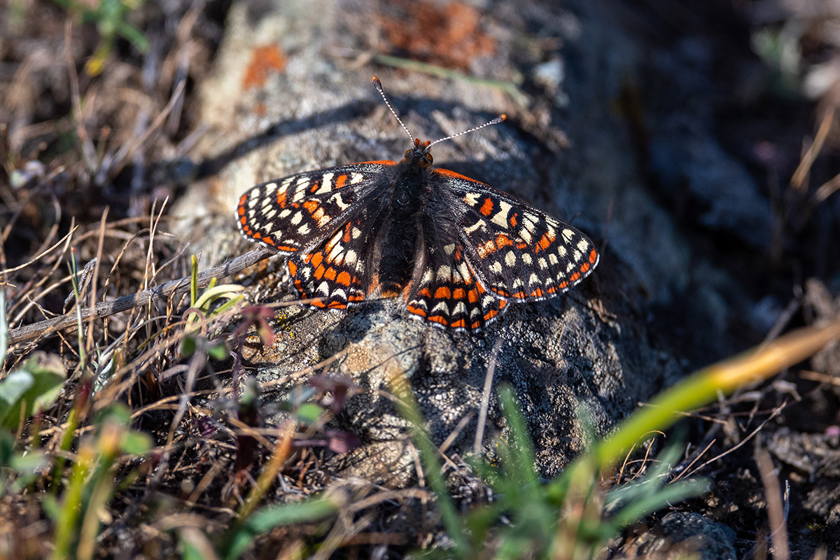
Máyyan ‘Ooyákma – Coyote Ridge Open Space Preserve. Photo by Scott Hein
More information: Máyyan ‘Ooyákma – Coyote Ridge (openspaceauthority.org)
Where: 9611 Malech Road, Morgan Hill, CA 95037
GPS coordinates: 37.21370197198247, -121.72092288287561
Size: 1,859 acres
Description: Only 20 minutes from downtown San Jose, Máyyan ‘Ooyákma – Coyote Ridge Open Space Preserve is the connecting point for over 1 million acres of important habitat in the Santa Cruz Mountains and the Diablo Range.
Comprised of rare, sensitive serpentine grasslands, this unique landscape is a biodiversity hotspot for imperiled plants and animals such as the Bay checkerspot butterfly, Metcalf Canyon jewel flower, California red-legged frog, California tiger salamander, tule elk, western burrowing owl, golden eagle, and numerous birds of prey.
You can learn more about the endemic Bay checkerspot butterfly by joining a docent-led hike through the Habitat Protection Area to learn about this special pollinator and the wildflowers it relies on.
Activities: hiking, biking, horseback riding, picnicking, birding, photography, painting, meditation, wildlife viewing.
- Trails: three trails inside the Habitat Protection Area: Serpentine Spring Trail, Tule Elk Trail, and Bay Checkerspot Trail.
- March through May, the Habitat Protection Area will be open by reservation only on Saturdays and Sundays, during which time the public must sign up for a free docent-led hike or event to access the area.
- Horses are welcome, but because of limited parking, reservations are required for equestrians transporting horses in trailers. Horse trailer parking is available Wednesday through Friday by reservation only.
- Dogs are not permitted.
Permits/fees: “Butterfly Pass”: a free year-round pass required to access the trails inside the Habitat Protection Area. When you obtain a Butterfly Pass, you agree that you have read and agree to follow the preserve rules.
Coyote Valley Open Space Preserve
Coyote Valley Open Space Preserve. Photo by Don DeBold | CC BY
More information: Coyote Valley (openspaceauthority.org)
Where: 550 Palm Avenue, Morgan Hill, CA 95037
GPS coordinates: 37.1713428628372, -121.72738465940935
Size: 348 acres
Description: Though small in size, Coyote Valley is a lovely preserve where you can enjoy a truly rural and wilderness experience only 20 minutes from downtown San Jose.
Located at the western edge of the Coyote Valley, this preserve provides a greenbelt between San Jose and Morgan Hill and is a critical wildlife linkage that allows wildlife to cross between the Santa Cruz Mountains and the Diablo Range.
Hike to the ridgetop for stunning views of Mount Hamilton, Mount Umunhum, and the entire Coyote Valley.
Activities: hiking, biking, horseback riding, trail running, birding, picnicking, photography, painting, meditation, and wildlife viewing.
- Trail: the four-mile Arrowhead Loop trail leads to a ridgetop with stunning views of Mount Hamilton, Mount Umunhum, and the entire Coyote Valley.
- Dogs are not permitted.
Permits/fees: Required for photography and filming and for all group activities.
Rancho Cañada Del Oro Open Space Preserve
Rancho Cañada Del Oro Open Space Preserve. Photo by Don DeBold | CC BY
More information: Rancho Cañada del Oro (openspaceauthority.org)
Where: 4289 Casa Loma Road, Morgan Hill, CA 95037
GPS coordinates: 37.14799800372855, -121.77455721472444
Size: 5,675 acres
Description: Rancho Cañada Del Oro is another slice of wilderness only 25 miles from downtown San Jose in the foothills of the Santa Cruz Mountains in southern Santa Clara County.
A glistening creek runs along the Llagas Meadow, and with any luck, you may see deer, bobcats, mountain lions, and other wildlife roaming throughout the preserve. Springtime is the best season to see wildflowers adorning the meadows and hillsides.
Activities: hiking, biking, horseback riding, trail running, birding, picnicking, photography, painting, meditation, and wildlife viewing.
- Trails: Bald Peaks, Catamount, Llagas Creek Loop, Mayfair Ranch, Mayfair Ranch–Longwall Canyon, and Mayfair Ranch–Longwall Canyon–Bald Peaks–Catamount.
- Dogs are not permitted.
Permits/fees: Required for photography and filming and for all group activities.
Sierra Vista Open Space Preserve
Sierra Vista Open Space Preserve as seen from the Aquila Loop Trail. Photo by Don DeBold | CC BY
More information: Sierra Vista (openspaceauthority.org)
Where: Sierra Vista Point, Sierra Road, San Jose, CA 95132
GPS coordinates: 37.41015983494749, -121.80170226372404
Size: 1,611 acres
Description: Sierra Vista Open Space Preserve is in the eastern foothills of Santa Clara County, only 25 minutes away from downtown San Jose.
This preserve offers sweeping views of the valley and the opportunity to stroll through diverse landscapes including oak woodlands, rolling grassland, and chaparral communities, characterized by their groups of shrubs.
Perched above Alum Rock Park, the area protects watersheds, areas of land that absorb water for it to flow into streams and reservoirs, like Penitencia Creek.
It is home to several protected wildlife species including the California red-legged frog, California tiger salamander, American badger, western burrowing owl, and other species such as golden eagle, mountain lion, bobcat, and gray fox.
With trails suited to varying levels of hikers, this is a great area to get out and explore with families of all ages.
Activities: hiking, biking, horseback riding, trail running, birding, picnicking, photography, painting, meditation, and sightseeing.
- Trails: the Aquila Loop Trail is a mellow hike, perfect for beginners and families with young children.
- No access to Sierra Vista from Alum Rock Park through Alum Rock Falls Road. No restrooms or water. Reservations are required for horse trailer parking. Dogs are not permitted.
Mount Diablo State Park

Mount Diablo State Park. Photo by Scott Hein
More information: Mount Diablo State Park (ca.gov)
Where: There are four main entrances to Mount Diablo State Park.
- North Gate Road entrance: 1300 North Gate Road, Walnut Creek, CA 94598
- South Gate Road entrance: 2675 Mount Diablo Scenic Boulevard, Blackhawk, CA 94506
- Macedo Ranch staging area: 3756 Green Valley Road, Alamo, CA 94507
- Mitchell Canyon staging area: 96 Mitchell Canyon Road, Clayton, CA 94517
GPS coordinates:
- North Gate Road entrance: 37.9025334226732, -121.99367053345605
- South Gate Road entrance: 37.84424375752378, -121.94921984695287
- Macedo Ranch staging area: 37.86313202708451, -121.97893603345858
- Mitchell Canyon staging area: 37.92312670131058, -121.93721154694812
Size: about 20,000 acres
Elevation range: 335 to 3,849 feet
Description: As mountains go, Mount Diablo is not particularly tall, only 3,849 feet. However, it is surrounded by low, rolling hills and broad, flat valleys, so atop the summit is one of the best panoramic views of the Bay Area.
When conditions are best, you can see almost 200 miles. There are many trails to explore, with habitats including oak and riparian woodlands, chaparral, and grasslands.
Trees include multiple species of oak, as well as bigleaf maple, Coulter pine, foothill pine, and California buckeye. Lilies and other spectacular wildflowers carpet the mountain in spring.
Mount Diablo is made of igneous, sedimentary, and metamorphic rock ranging from 190 million to 10 million years old.
The summit is volcanic rock, erupted from undersea volcanoes thousands of miles to the west and transported to the area by movement of the earth’s tectonic plates.
Mount Diablo itself is not a volcano but was formed in the past couple of million years by the folding and faulting of the earth’s crust.
Mount Diablo is a sacred place for Native Californians and home to many tribes, including the Volvon, Chupcan, Tatcan, and Souyen. The Julpun tribe who occupied the Delta area recognized the mountain as the birthplace of the world.
Activities: Summit views, camping, hiking, biking, birding, rock climbing, horseback riding, trail running, picnicking, photography, painting, meditation, and wildlife viewing.
- Summit Visitor Center: Open daily 10 AM to 4 PM, located in the historic stone building atop Mount Diablo’s highest peak.
- Picnicking: there are more than 50 picnic sites with tables and barbecue stoves. Three group picnic areas serve 20 to 50 people each.
- Camping: More than 50 individual campsites with nearby showers and flush toilets. Five group campsites have pit toilets and running water.
- Dogs are only allowed in developed areas of the park and must be kept on a leash during the day and in an enclosed vehicle or tent at night.
Permits/fees: vehicle entrance fee is $10 at North and South Gates, cash or check anytime, and credit/debit card when the kiosk is staffed and a QR code when unstaffed; vehicle entrance fee is $6 at Macedo Ranch and Mitchell Canyon staging areas, cash or check only.
Reservations are required for campsites.
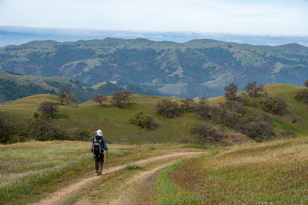
Henry W. Coe State Park
Henry W. Coe State Park. Photo by Bruce and Joan Hamilton
More information:
Where:
- Main Coe Ranch entrance/visitor center: 9000 East Dunne Avenue, Morgan Hill, CA 95037
- Hunting Hollow entrance: 4826 Gilroy Hot Springs Road, Gilroy, CA 95020
- Dowdy Ranch entrance: Open on some weekends in April, but closed during Coe Backcountry Weekend on April 26 to 28. Call San Juan Bautista State Historic Park and speak with park staff before you go. You can reach park staff every day between 10:00 am to 4:30 PM at 831-623-4881.
GPS coordinates:
- Main Coe Ranch entrance/visitor center: 37.18654011957993, -121.54617577409577
- Hunting Hollow entrance: 37.076090889706755, -121.4670592317707
Size: 87,000 acres
Elevation range: 300 to 3,560 feet
Description: Henry W. Coe State Park is the largest state park in northern California. The park’s terrain is rugged, varied, and beautiful, with lofty ridges and steep canyons.
With such an expanse of wilderness, recreational opportunities are numerous and diverse. And with over 250 miles of hiking trails, it will take a long time to explore every corner of the park.
Spring is an incredible time to visit the park for the colorful display of wildflowers. The landscape is rich with blue lupines, orange-yellow California poppies, Mariposa lilies, larkspurs, wild hyacinths, and Ithuriel’s spears depending on the month you visit.
Activities: hiking, camping, backpacking, mountain biking, horseback riding, fishing, trail running, birding, photography, painting, picnicking, meditation, and wildlife viewing.
- Hiking: the park has over 250 miles of hiking trails and old ranch roads that can be traveled in all seasons. Hikes range from leisurely loops of a mile and a half with little elevation variations to highly ambitious backpacking loops of 50 miles or more with elevation gains and losses in the thousands of feet.
- Biking: the park has over 200 miles of roads and trails that are open to mountain bikes. The rugged terrain offers a variety of riding operations ranging from moderately difficult to extremely difficult. There are practically no easy trails for bikes. Bikes are to yield the right of way to hikers and horses.
- Fishing: Henry W. Coe State Park has great fishing, with largemouth bass, green sunfish, crappie, and bluegill in its lakes and ponds in addition to rainbow trout in the creeks. You cannot drive to any of the lakes or creeks. Most fishing ventures require considerable expenditure of time and energy into Coe’s backcountry. All state and federal rules apply and are enforced.
- Horseback riding and camping: there are six designated horse camps in the park. Each has a set of pipe corals that will hold at least two horses. All camps have a spring, pond, lake, or creek nearby, but these water sources are unreliable. Water must be purified for human consumption. Horse camp fees are $25 per night.
- Camping: Drive-in camping is available at the Coe Ranch entrance campground. Each of the 19 drive-in campsites has a picnic table and fire pit with a grill grate. Vault toilets and potable water are near each site. There are restrooms with flush toilets in the visitor center. There are no showers or RV hook-ups. Reservations are required or first-come, first-serve. Dogs are allowed in the campground, on paved roads, and on one trail.
- Backpacking: Permits are required and issued on a first-come, first-served basis at the Coe Ranch and Hunting Hollow entrances. Dogs and ground fires are not allowed in the backcountry.
- Dogs are allowed only at the Coe Ranch entrance in the Coe Ranch Campground, paved areas, and the 0.5-mile Live Oak Trail that connects the visitor center to the entrance parking lot. Dogs are allowed in the campground.
Permits/fees: Entrance fee is $8 for day use, drive-in camping is $20, group camping is $75, backpacking is $5, and horse camping is $25 per night.
Pacheco State Park
Pacheco State Park. Photo by Ted Clement
More information: Pacheco State Park (ca.gov)
Where: 38787 Dinosaur Point Road, Hollister, CA 95023
GPS coordinates: 37.06524417706698, -121.21155468932898
Size: 6,890 acres
Description: Pacheco State Park is the last remaining portion of the Mexican land grant, El Rancho San Luis Gonzaga. This land has been a horse and cattle ranch since 1843 and offers breathtaking views of the Central Valley and Santa Clara Valley.
During the mild spring and fall months, visitors are encouraged to roam the hills that have been traversed by Central Valley Yokut Indians, Spanish missionaries and soldiers, Mexican vaqueros, gold seekers, and bandits.
During the spring the park’s grassy slopes abound with blossoming wildflowers.
- Activities: mountain biking, springtime guided walks, hiking, horseback riding, picnicking, trail running, birding, photography, painting, meditation, and wildlife viewing.
- Trails: There are 28 miles of trails that offer several loops to give visitors the choice of a hike or ride from one to twenty miles or more.
- Dogs are not allowed on the trails.
Permits/fees: $10/day use fee per vehicle.
Fremont Peak State Park
Fremont Peak State Park. Photo by Alexander Broom
More information: Fremont Peak State Park (ca.gov)
Where: 10700 San Juan Canyon Road, San Juan Bautista, CA 95045
GPS coordinates: 36.76246053830843, -121.50358865529482
Size: 159 acres
Elevation range: 3,169 feet
Description: Becoming a state park in 1936, Fremont Peak offers magnificent vistas of Monterey Bay; the Salinas and San Benito valleys are incomparable from the 3,169-foot peak.
Also visible are the Santa Cruz, Diablo, and Gabilan ranges, and the Santa Lucia Mountains.
Far enough away from light-polluted cities, Fremont Peak is an idyllic stargazing destination. Visit between April and October to attend astronomy programs offered at the observatory.
The northern slopes of the park are covered with manzanita, scrub oak, toyon, and coyote brush, and the southern side is open grasslands.
Some of the fauna you might see include turkey vultures, hawks, chickadees, finches, hummingbirds, thrushes, woodpeckers, coyotes, snakes, bobcats, raccoons, alligator lizards, and foxes.
Activities: camping, hiking, stargazing, picnicking, biking, trail running, painting, photography, birding, meditation, and sightseeing.
Observatory: visitors can enjoy a short program about the current night sky and view its starry wonders from the observatory’s 30-inch-diameter telescope.
Astronomy programs take place from April through October on Saturday evenings without a full moon.
Camping: 25 primitive campsites with tables, fire rings, and pit toilets. One group site holds 50 campers. Campsite reservations are needed.
Dogs are only allowed in developed areas of the park and must be kept on a leash during the day and in an enclosed vehicle or tent at night.
Permits/fees: $6 vehicle fee at parking area, cash or check only. Reservations are required for campsites.
Morgan Territory Regional Preserve
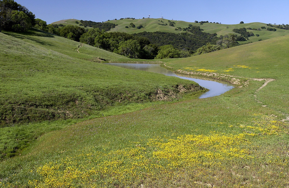
Morgan Territory Regional Preserve. Photo by Scott Hein
More information: Morgan Territory Regional Preserve | East Bay Parks (ebparks.org)
Where: 9401 Morgan Territory Road, Livermore, CA 94551
GPS coordinates: 37.81858386857998, -121.79587735493101
Size: 5,323 acres
Description: Sandstone hills within the park are adorned in spring with more than 90 species of wildflowers, including the Diablo sunflower, which grows only in the foothills of Mount Diablo.
Deer, coyote, and even mountain lions may be seen here, and a variety of raptors frequently soar overhead.
Activities: biking, camping, hiking, horseback riding, picnicking, backpacking, trail running, birding, photography, painting, meditation, and wildlife viewing.
Dogs are allowed.
Permits/fees: No parking or dog fees.
Brushy Peak Regional Preserve

Brushy Peak Regional Preserve. Photo by Seth Adams
More information: Brushy Peak Regional Preserve | East Bay Parks (ebparks.org)
Where: North end of Laughlin Road, Livermore, CA
GPS coordinates: 37.74688832644929, -121.709096348808
Size: 1,979 acres
Description: Brushy Peak is a 1,702-foot historic landmark at the juncture of the San Francisco Bay Area, the California Delta, and the Central Valley and is a wonderful place full of indigenous history.
This landscape has been recognized as sacred by generations of Native Californians, who were drawn to the peak for economic, social, and ceremonial events.
The Ssaoam triblet of the Ohlone peoples was probably the most closely linked to the Brushy Peak area, living in the surrounding dry hills and tiny valleys around the peak and nearby Altamont Pass.
California annual grassland is the dominant habitat, with areas of alkali seasonal wetlands, woodland habitats, and shrublands. The preserve is home to numerous plant and animal species. Native and non-native grasses and wildflowers, amphibians, reptiles, small mammals, and raptors all make their home here.
Activities: hiking, biking, dog walking, horseback riding, mountain biking, trail running, picnicking, painting, photography, birding, meditation, and nature study.
Dogs: dogs must be on leash at all times in the preserve to protect the area’s fragile natural resources
Hiking: look out for interpretive program offerings such as guided hikes. There are at least six trail offerings.
Permits/fees: None
Sunol Wilderness Regional Preserve
Sunol Wilderness Regional Preserve. Photo by Cooper Ogden
More information: Sunol Wilderness Regional Preserve | East Bay Parks (ebparks.org)
Where: 1895 Geary Road, Sunol, CA
GPS coordinates: 37.516453885651586, -121.8319695906014
Size: 6,859 acres
Description: The Sunol Wilderness Regional Preserve is known for its array of naturalist program offerings. From naturalist-led nature hikes to birding outings to family activities, this preserve is the perfect destination for adventure opportunities with a guide.
It’s an ideal destination for your everyday geologist. Exploration will reveal sandstone outcrops with fossils deposited in what was once an ancient seabed. Great boulders of greenstone, schist, and meta chert indicate a turbulent past.
Alameda Creek harbors an inviting creekside community of alder, willow, and sycamore. Coast live oaks abound along with valley and blue oak, elderberry, madrone, and gray pine. Spring brings wildflowers, including California poppies, mustard, goldfields, and lupines, which carpet vast areas in yellow, orange, and blue.
Ground squirrels, yellow-billed magpies, and red-tailed hawks share this wilderness with raccoons, skunks, and black-tailed deer. Mountain lions are uncommon but occasionally sighted.
- Activities: biking, camping, hiking, horseback riding, trail running, picnicking, rock climbing, birding, photography, painting, meditation, and wildlife viewing.
- Visitor center: Naturalist staff can help provide trail suggestions, share about recent animal sightings, sell you an Ohlone Wilderness trail permit, and introduce you to their animal ambassadors. The Sunol herbarium has samples of over 600 plant specimens found in the park. Naturalists lead walks, hikes, birding outings, family activities, nature arts and crafts, virtual programs, and various other adventures.
- Rock climbing: The massive basalt outcrop at Indian Joe Cave Rocks provides sport and challenge to rock climbers.
- Birding: Superb birding along Alameda Creek with acorn woodpeckers, black phoebe, titmouse, turkey vulture, and golden eagle commonly sighted. As many as 20 to 40 bird species are often seen in a single morning.
- Backpack area: camping is by advance reservation only. The backpack area is open year-round. An Ohlone Wilderness permit is required for each person age 12 years or older. The fee for in-person purchase is $2/person/year; by mail/phone/online $4/person/year for the first five permits and $3/person/year for each additional permit after five.
- Dogs are allowed.
Permits/fees: Parking $5 weekends and holidays, $4 per trailered vehicle. $25 per bus. $2 per dog, guide/service dogs free.
Ohlone Wilderness Regional Preserve
Ohlone Wilderness Regional Preserve. Photo by Scott Hein
More information: Ohlone Wilderness Regional Preserve | East Bay Parks (ebparks.org)
Where:
- Enter from Del Valle Regional Park: 7000 Del Valle Road, Livermore, CA 94550
- Enter from Sunol Wilderness Regional Preserve: 1895 Geary Road, Sunol, CA
- Enter from Mission Peak Regional Preserve: 43600 Mission Blvd., Fremont, Stanford Avenue Staging Area
GPS coordinates:
- Del Valle Regional Park: 37.56973586356729, -121.68733683162733
- Sunol Wilderness Regional Preserve: 37.516453885651586, -121.8319695906014
- Mission Peak Regional Preserve: 37.531859527819414, -121.91140747526957
Size: 9,737 acres
Description: The Ohlone Wilderness Regional Preserve is a remote and beautiful wilderness area only accessible through hiking or horseback riding by way of the Ohlone Wilderness Trail from Del Valle Regional Park, Sunol Wilderness Regional Preserve, or Mission Peak Regional Preserve.
Its centerpiece is 3,817 Rose Peak, just 32 feet lower than Mount Diablo. The landscape is a nature photographer’s dream, with oak and bay woodlands, grassy uplands carpeted with springtime wildflowers, and wilderness ridges and peaks. The abundance of wildlife includes bald eagles, bobcats, deer, golden eagles, mountain lions, and tule elk.
Activities: camping, backpacking, hiking, horseback riding, birding, trail running, photography, and wildlife viewing.
The Ohlone Trail passes through the Ohlone Wilderness and three regional parks: Mission Peak Regional Preserve, Sunol Regional Wilderness near Pleasanton and south of Sunol, and Del Valle Regional Park. The trail traverses 28 miles of mountains and canyons and has four campsites within the Ohlone Wilderness. With over 7,600 feet of elevation gain, this trail is not for beginners, but could be a good introduction to backpacking for a seasoned day hiker. Hikers will enjoy scenic vistas and marvel at being in such a remote place so close to the metropolis of the Bay Area.”
Dogs are allowed.
Permits/fees: Parking $5 weekends and holidays, $4 per trailered vehicle. $25 per bus. $2 per dog, guide/service dogs free. An Ohlone Wilderness permit is required for both day use and camping/backpacking for each person ages 12 years and older.
The fee for in-person purchase is $2/person/year; by mail/phone/online $4/person/year for the first five permits and $3/person/year for each additional permit after five.
A separate camping reservation is required if you plan to stay overnight at one of the designated campsites along the Ohlone Wilderness Trail.
Curry Mountain (BLM)
More information: Curry Mountain | Bureau of Land Management (blm.gov)
Where: 37577 CA Hwy 198, Coalinga, CA 93210
GPS coordinates: 36.094871, -120.458590
Size: about 1,800 acres
Description: Curry Mountain has an elevation of over 2,000 feet and a beautiful view of the surrounding mountains. The regional topography is very steep and rugged, but great for hiking and wildlife viewing.
You may see California mule deer, gray foxes, bobcats, pigs, newts, and ground squirrels in this region. Quail and doves are common bird species here, and you have a chance of spotting horned larks, Brewer’s sparrows, ash-throated flycatchers, golden-crowned sparrows, and greater roadrunners as well.
Activities: camping, hiking, hunting, horseback riding, trail running, picnicking, birding, painting, photography, meditation, and wildlife viewing.
Hunting: There are three main types of hunting available, including upland game bird, small game, and big game like deer and wild pigs. Varmint (non-game) hunting is also allowed.
The California Department of Fish and Wildlife regulates the hunting seasons for different species and the types of firearms allowed for use. Please be aware that this region is home to the California condor, which affects non-game hunting.
At Curry Mountain, hunting opportunities are fair to good for quail, chukar, and other small game as well as deer and wild pig.
Permits: Parking access onto nearly 1,800 acres of Bureau of Land Management property in this area is provided through an easement from the California Department of Fish and Wildlife. The parking easement site is along the north side of State Highway 198, east of Parkfield Junction and six miles west of Coalinga.
The trailhead is located across the road on the south side of Highway 198. There is a kiosk located in the parking area providing an interpretive panel, a map, and information about the area. There are no facilities, and there is running water or trash collection.
Coalinga Mineral Springs (BLM)
More information: Coalinga Mineral Springs | Bureau of Land Management (blm.gov)
GPS coordinates: 36.146346, -120.555588
Description: The Coalinga Mineral Springs National Recreation Trail was designated under the National Recreation Trails System Act in 1981. The trail is located on the scenic southern tip of the Diablo Mountains.
Panoramic views of the southern Diablo Mountains from Kreyenhagen Peak are truly breathtaking. There are many rock outcrops atop Kreyenhagen Peak that offer inviting seats for lunch or to simply reflect on the landscape.
The area is a mixed chaparral-foothill vegetation community where visitors can encounter grey pine, chamise, manzanita, yucca, and many other shrubs and annual wildflowers.
Activities: hiking, mountain biking, horseback riding, hunting, trail running, birding, photography, picnicking, painting, meditation, and wildlife viewing.
- Watchable wildlife: Along the trail, you may encounter California mule deer, quail, squirrels, mourning doves, feral pigs, grey foxes, bobcats, and many others.
- Hiking: Trailhead parking is located at Coalinga Mineral Springs County Park. The trailhead is located across the creek from the Coalinga Mineral Springs County Park. There is no longer any running water or facilities at the county park, and there are no facilities along the trail except for directional signs. There is an information board and map box located at the trailhead. Once on the trail, the visitor has over 2.5 miles of continuous trail to hike on which leads to the top of Kreyenhagen Peak. The trail width is between 18 and 24 inches, and 48 inches in hazardous areas to provide safety to the hiker and equestrian.
- Hunting: The entire landscape of Coalinga Mineral Springs burned in the 2020 Mineral Fire. As of spring 2021, there has been little vegetation recovery to support wildlife or game.
Permits: Check with BLM.
Pinnacles National Park (East/West)

California condors at Pinnacles National Park. Photo by Sean Burke
More information: Pinnacles National Park (National Park Service) (nps.gov)
Where: 5000 East Entrance Road, Paicines, CA, 95043 / Soledad, CA 93960
GPS coordinates: 36.494438944565665, -121.14656873692363 / 36.47856000514703, -121.2258556656549
Size: 26,000 acres
Elevation range: gain up to 3,304 feet
Description: Some 23 million years ago, a volcano in Lancaster erupted, flowed, and traveled rocks some 200 miles to form what would become Pinnacles National Park. What remains is a unique landscape.
Travelers journey through chaparral, oak woodlands, and canyon bottoms.
Hikers enter rare talus caves, home to the largest maternity colony of Townsend’s big-eared bats between San Francisco and Mexico, and emerge to towering rock spires teeming with life: prairie and peregrine falcon, golden eagle, and the inspiring California condor.
The California condor is the largest land bird in North America, with a wingspan of almost 10 feet.
Pinnacles joined the California condor recovery program in 2003 and has helped recover condor numbers from the edge of extinction both in the wild and in captivity.
More than 48 mammal species, aside from humans, are known to occur within Pinnacles National Park. Those often seen and enjoyed by visitors and staff include black-tailed deer, bobcat, gray fox, raccoon, jackrabbit, brush rabbit, ground squirrel, chipmunk, and several kinds of bat.
There are reptiles like the coachwhip, and rattlesnakes as well.
Activities: camping, hiking, rock climbing, picnicking, birding, painting, trail running, photography, meditation, and wildlife viewing.
- Camping: Pinnacles is a popular camping spot, so book your reservation well in advance to guarantee a spot. The campground offers tent and group camping, along with RV sites. Each tent and group site has a picnic table and fire ring. Water is located throughout the campground. Coin-operated showers and a dump station are available.
- Hiking: there are more than 30 miles of trails that showcase the beauty of the park. Hikes range from flat stretches of grasslands to uphill climbs through talus caves onward to the rocky spires that Pinnacles is famous for. If you are new to the park, consult with a ranger at the Pinnacles East Entrance Station, the Bear Gulch Nature Center, or the West Pinnacles Visitor Contact Station.
- Rock climbing: the rocks are volcanic breccia. If you are used to granite, it is wise to take a cautious approach. If this is your first trip, you should lead well below your usual level to get used to the weak rock and often questionable or nonexistent protection. Wear a helmet, inspect all bolts carefully, test rocks as you go, and be prepared with the necessary gear including a headlamp with extra batteries and bulbs, extra clothing, and plenty of food and water.
- Birding: Birders of all levels and ages can hope to see not just the charismatic California condor, but some of the 181 other species that have been documented in the park. Birding is much more productive and satisfying with a pair of binoculars in the 7 to 10 power range.
- Pets are permitted in paved areas of the park, including parking lots, picnic areas, and the campground, but are prohibited on all hiking trails. Pets must be on a leash and attended at all times.
Permits/fees: Entrance fee $15 to $30.
Kern National Wildlife Refuge
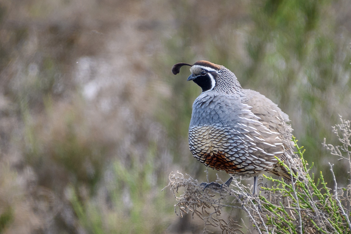
California quail at the Kern National Wildlife Refuge. Photo by Becky Matsubara | CC BY
More information: Kern National Wildlife Refuge | US Fish and Wildlife Service (fws.gov)
Where: 10811 Corcoran Road, Delano, CA 93215
GPS coordinates: 35.763535354584086, -119.58340989874777
Size: 11,249 acres
Description: Kern National Wildlife Refuge is an excellent area for avid birders to see waterfowl, shorebirds, and other wetland-dependent species.
For thousands of years, California’s Central Valley has provided habitat for millions of wetland-dependent species. The San Joaquin Valley once contained numerous lakes and marshes comprising of over 800,000 acres of natural wetlands, the largest freshwater marsh in the western United States.
Through restoration and maintenance of native habitat diversity, the refuge provides suitable habitat for several endangered species as well as preserving a remnant example of historic valley uplands in the San Joaquin Desert.
The best time of year to observe wildlife is fall through spring. Mammals and reptiles can be difficult to find in the daytime, although ground squirrels and coyotes are frequently seen during daylight.
Rattlesnakes, and side-blotched, whiptail, and western fence lizards can also be easily observed during the day. Refuge ponds are generally dry during May through August, resulting in limited opportunities to see wildlife.
Activities: hiking, driving, hunting, birding, biking, horseback riding, trail running, picnicking, photography, painting, meditation, and wildlife viewing.
- Driving: a year-round six-mile auto route leads through some of the wetlands.
- Birding: best from October through March.
- Hunting: the refuge is considered one of the three best public waterfowl hunting areas in California. The hunting includes both free-roam areas and blinds reserved via the California Department of Fish and Wildlife. Shoveler is the most common bird on the refuge, but cinnamon and green-winged teal, gadwall, wigeon, and pintail are all present. Sport hunting is permitted on the refuge in accordance with all state and federal regulations.
- Hiking: allowed in all areas open to the public. Wildlife observation and photography are encouraged. There are four main trails to explore.
- Biking: only allowed on designated public access routes. Bikes are not allowed on trails or roads closed to public vehicles or horses.
- Horseback riding: allowed on signed refuge public access routes open to motor vehicles.
Permits/fees: Check with the refuge.
Mount Hamilton–Lick Observatory
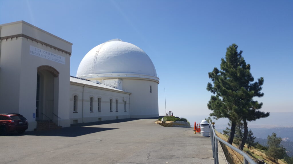
Lick Observatory on Mount Hamilton is operated by the University of California. Photo by Alexander Broom
More information:
Where: 7281 Mount Hamilton Road, Mount Hamilton, CA 95140
GPS coordinates: 37.34231444742978, -121.64039996047676
Elevation range: up to 4,265 feet
Description: Mount Hamilton is a major stretch of wild land between Silicon Valley and the Central Valley. Urban development menaces Mount Hamilton, which is sandwiched between densely populated areas.
Conservation efforts here provide a refuge for endangered species such as the San Joaquin kit fox and the Bay checkerspot butterfly. Bobcat, mountain lion, tule elk, red-legged frog, and countless bird species all make their home in this diverse environment.
Mount Hamilton contains some of the most scenic and the most vulnerable natural settings in California. It supports majestic oaks, rare native grasses, and fields teeming with wildflowers.
Streamside forests, woodlands, and grasslands form a critical part of the watershed that guarantees a healthy water supply to Bay Area residents.
For a unique experience, the Lick Observatory sits atop Mount Hamilton’s peak and provides visitors with daytime and nighttime activities including walking tours, concerts, and celestial observations.
- Activities: Lick Observatory, stargazing, hiking, biking, trail running, picnicking, photography, painting, meditation, and wildlife viewing.
- Lick Observatory: Visitor Center is open 12 to 5 PM Saturdays and Sundays. Parking and admission are free.
- Hiking: there are 22 scenic trails in the Mount Hamilton area
Permits/fees: Joseph Grant County Park, which is located on Mount Hamilton, charges a $6 daily fee.
Frank Raines Regional Park and Minniear Day Use Area (Del Puerto Canyon)

Frank Raines Regional Park and Del Puerto Canyon. Photo by Scott Hein
More information: Frank Raines OHV | Stanislaus County Parks and Recreation (stancountyparks.com)
Where: 17802 Del Puerto Canyon Road, Patterson, CA
GPS coordinates: 37.426377243384785, -121.38135695767072
Size: More than 1,000 acres
Elevation range: TBD
Description: Frank Raines Regional Park in Del Puerto Canyon is an ideal destination for a multitude of recreational opportunities. The region is ideal for play and beautiful wild land exploration.
The region has incredible species diversity, including rare fire-following flowers.
Frank Raines offers the rugged slopes of California’s Coast Range and is functionally divided into three units, separated by several miles of road.
The Minniear Day Use Area encompasses undeveloped land designed for non-motorized recreation use, perfect for a free hiking destination filled with amazing wildlife and scenic vistas. These biodiverse hillsides are especially spectacular during the spring and early summer as the serpentine hosts copious rare flora after the 2020 burn, including globe gilia, tufted poppies, golden eardrops, and whispering bells, to name a few.
The Frank Raines Day Use Area provides picnic tables, barbecues, a themed playground, and more. The Frank Raines Off-Highway Vehicle Park is located across from the day-use area and offers campsites.
Activities: camping, off-roading, mudding, motocross, deer and wild pig hunting, biking, hiking, trail running, volleyball, playground, RC crawling, horseback riding, photography, painting, picnicking, birding, meditation, and wildlife viewing.
- Camping: Deer Creek campground is available by reservation with 34 full hook-up campsites.
- Dog friendly.
Permits/fees: day use vehicle $5, camping $15-$30, hunting permits required.

