Little-known Fremont Peak lies just west-of-center in the Diablo Range and climbs a modest 3,171 feet from the nearby Monterey Bay. This hidden gem offers a vantage point that’s as rich in early Californian history and unique geology as it is in breathtaking views.
The mountain bears a name borne from controversy.
And though the state park is modest in size at just 159 acres, it offers an immense treasure trove of natural beauty, geological wonders, and cultural significance waiting to be explored by those willing to venture to its slopes.
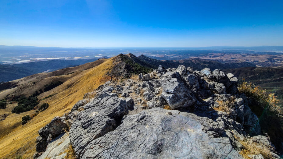
The view to the north from the summit of Fremont Peak.
Captain John C. Fremont
As the story goes, American Captain John C. Fremont—often regarded as the “Pathfinder of the West” for his explorations of the American West in the 19th century—camped on the peak in 1846 during a survey of the Salinas area, then still part of Mexico’s Alta California.
He took refuge on Gavilan Peak, as it was then called, after an altercation with General Jose Castro, commandant at the Monterey Presidio, who had ordered Fremont to leave California. “Gavilán” is the Spanish word for “hawk.”
In defiance, Fremont built a log stockade and raised a US flag at the top of the peak that now bears his name. Shortly thereafter, however, he and his troops departed in the middle of the night to avoid a confrontation with Mexican troops.
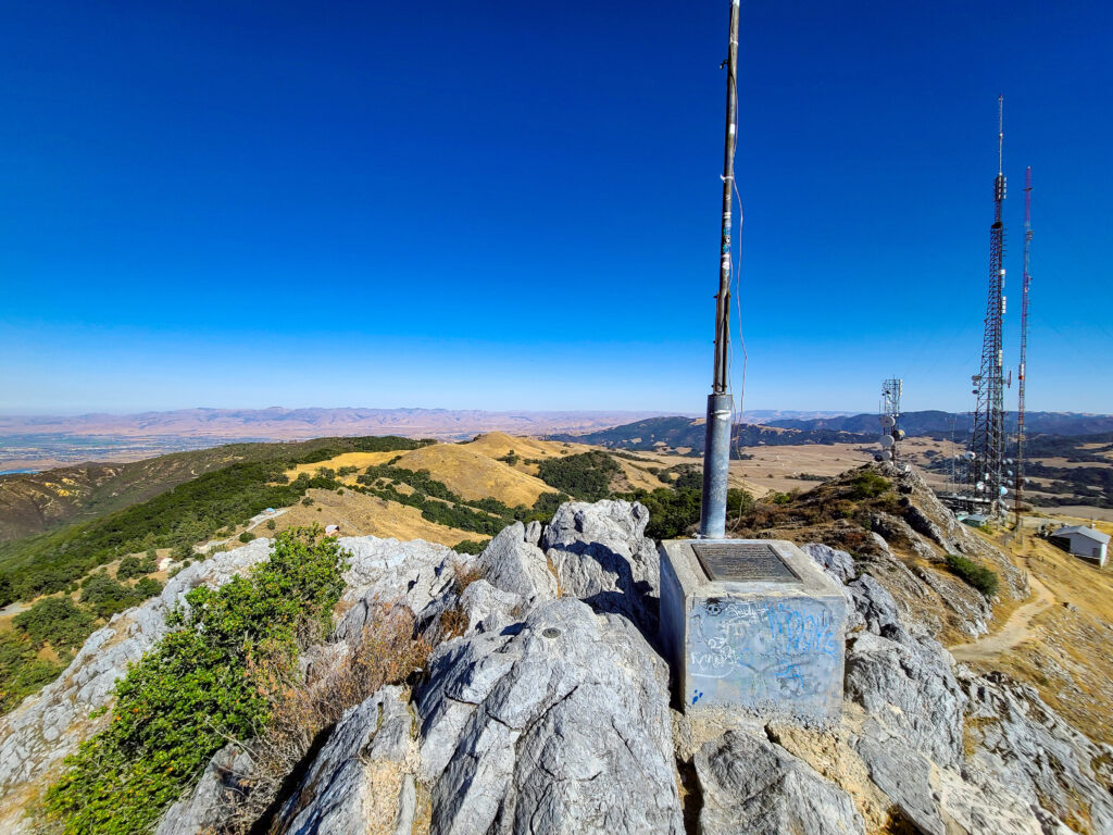
A monument to John C. Fremont sits atop the peak.
This conflict obviously didn’t help tensions leading up to the Mexican-American War. Fremont’s defiance and his role in the events of the time would later make him a prominent figure in the history of westward expansion in the United States.
After the expedition retreated, it’s said that word was going around about plans for a potential attack brewing by some Native Americans against white settlers.
Fremont would soon after order the attack sparking the Sacramento River Massacre, and is responsible for what is thought to be several hundred Native American deaths from that incident alone.
This is just a small portion of Fremont Peak’s extensive history, but more can be found in the state park brochure. Survey markers are still present and embedded in the marble peak.
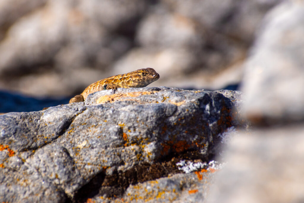
A western fence lizard (Sceloporus occidentalis) basking on some exposed marble.
Fremont Peak’s Sense of Place
Although it’s not the highest point in San Benito County, Fremont Peak might have some of its best views. It offers stunning views of the surrounding landscape, including parts of San Benito County and the nearby Monterey Bay.
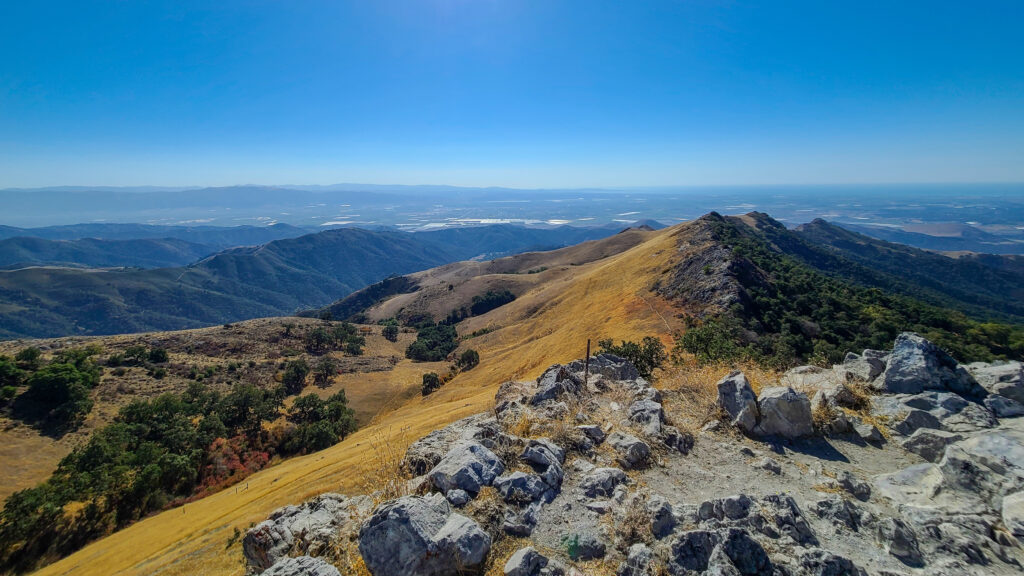
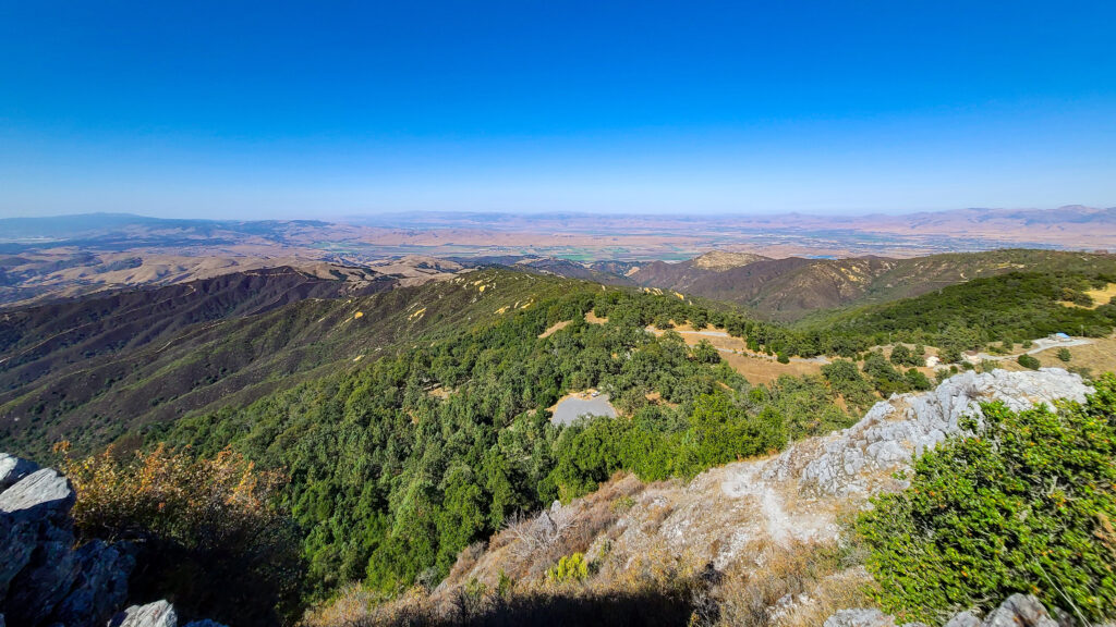
Salinas and the southern reaches of Monterey Bay in the far distance.
Looking to the west from its peak, you can see Santa Cruz to the north and Monterey and Pacific Grove to the south.
The panoramic views don’t end there, with views of Henry W. Coe State Park to the northeast; Gilroy, Hollister, and the Quien Sabe volcanic peaks to the east; the San Benito River valley; and some of the more remote parts of the Diablo Range lying beyond.
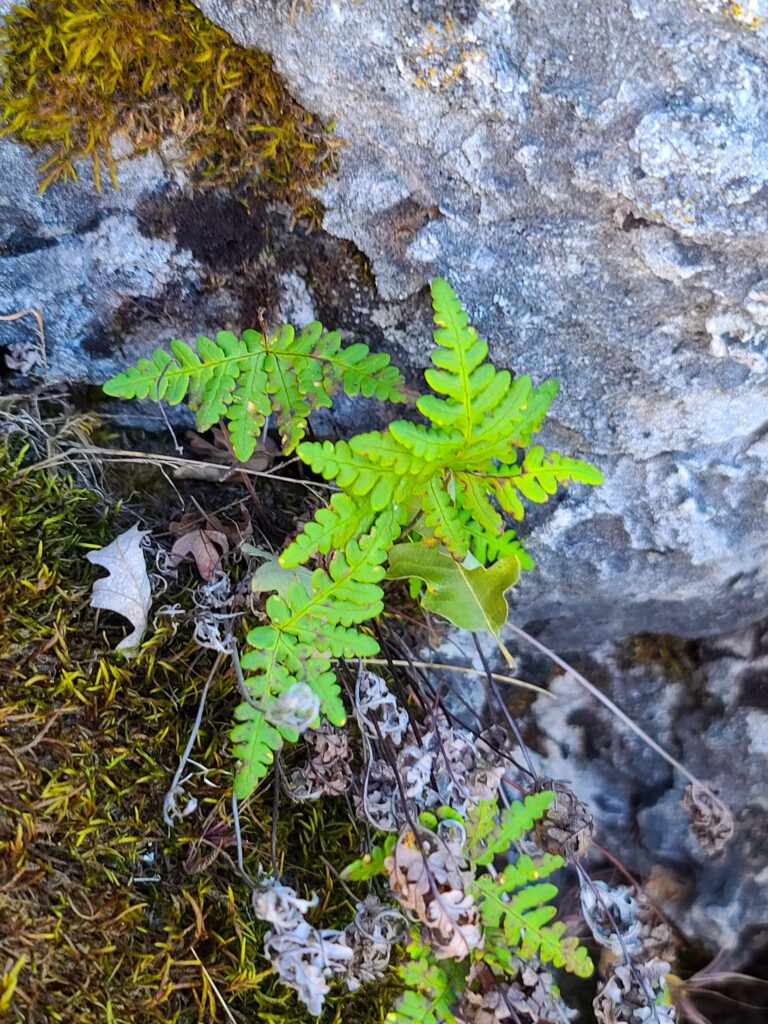
Goldback ferns (Pentagramma triangularis) are hiding in many of the shaded places on Fremont Peak.
Fremont Peak, with its rich history and spectacular natural surroundings, holds a special place in the hearts of San Benito County residents. It is a place where the past and the present converge, creating a distinct sense of connection to the land.
For the few who know, it’s more than just a peak; it’s an archive of California’s early history, and testament to the enduring beauty of the rugged landscape.
There are many six-legged friends to encounter in the park.
Fremont Peak’s Unique Geology
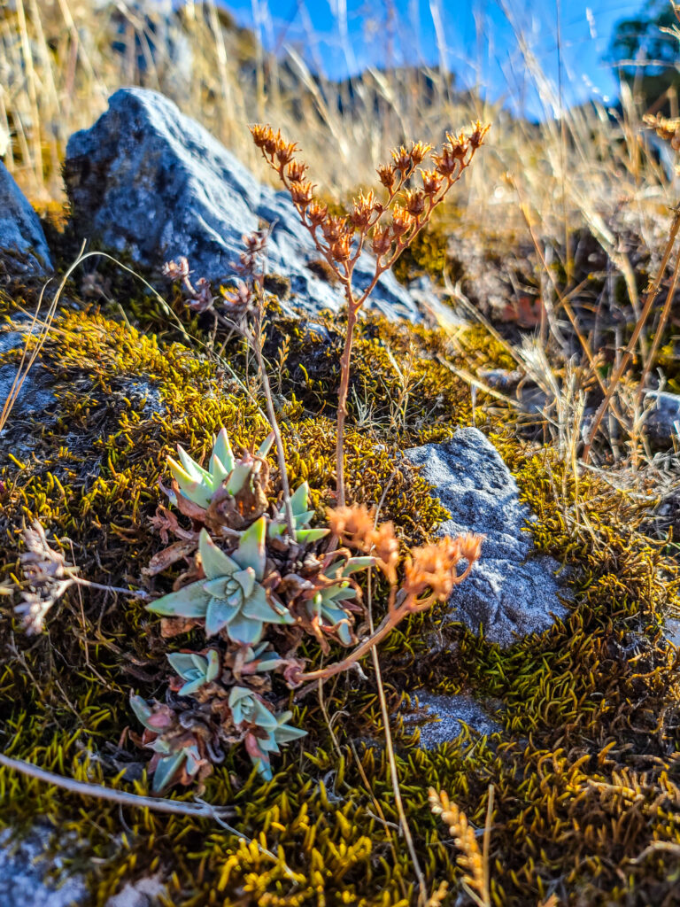
Fremont Peak State Park boasts a geological wonder that sets it apart from many other state parks in California: exposed marble.
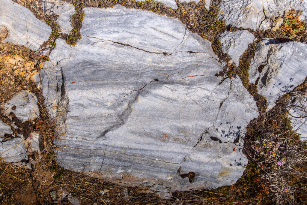
A look at the striations in the exposed marble on Fremont Peak.
The presence of this unique geological feature is not only visually stunning but also holds significant educational and scientific value: it provides a challenging environment for many specialized plants.
According to Doris Sloan, who wrote about the peak’s unique geology in Bay Nature, “The Gavilan Range is composed of granitic and metamorphic rocks found only west of the San Andreas.”
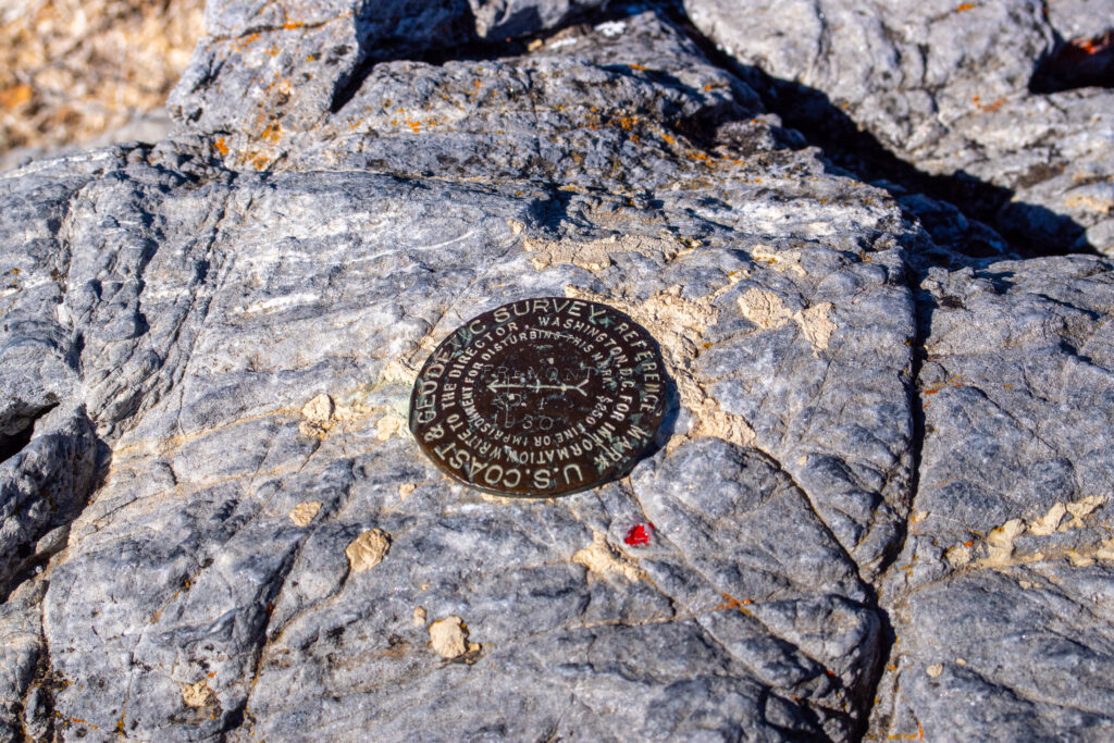
A US Coast & Geodetic Survey marker from 1930 stamped into the marble-covered Fremont Peak.
Sloan describes this geologist’s paradise.
She writes that marble, schist, quartzite, granitic rocks, dolomite, limestone, and mudstone are all found in the Gavilan Range (part of the Diablo Range) and that some began as sediments approximately 300 to 500 million years ago.
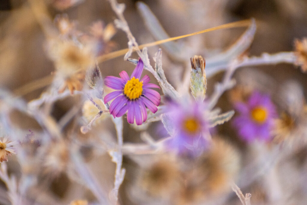
The peak was covered in the late-stage blooms of the California aster (Corethrogyne filaginifolia).
Unique Earth Leads to Unique Life
As mentioned, Fremont Peak is home to an abundance of uncommon geology and soils, which means it’s also home to unusual plants.
Some of the plants you’re likely to find on the peak are entirely different from those you may see on other nearby peaks, and vastly different than those seen on the way up.
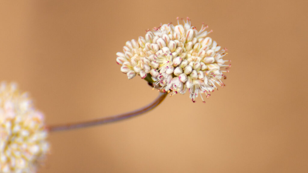
An umbel of flowers on a naked-stem buckwheat (Eriogonum nudum).
The late spring is likely the best time to visit, when a great variety and sheer abundance of wildflowers are present.
Those who visit in the late summer and early fall will find an abundance of wild buckwheats (Eriogonum sp.) and California fuchsia (Epilobium canum).
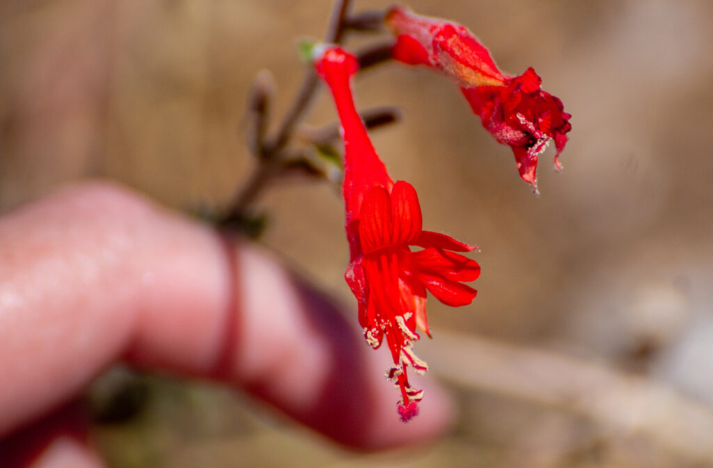
A close-up look at some California fuchsia (Epilobium canum) found at Fremont Peak.
The dudleyas (Dudleya sp.) and woollypod milkweeds (Asclepias eriocarpa) have already released their seeds, and the few nearby oaks will begin dropping their acorns.
Red-tailed hawks, crows, and vultures soar overhead on the regular, but a lucky few may be graced with the presence of the California condor venturing over from nearby Pinnacles National Park.
A canyon liveforever (Dudleya cymosa) among moss and lichens with its inflorescence going to seed.
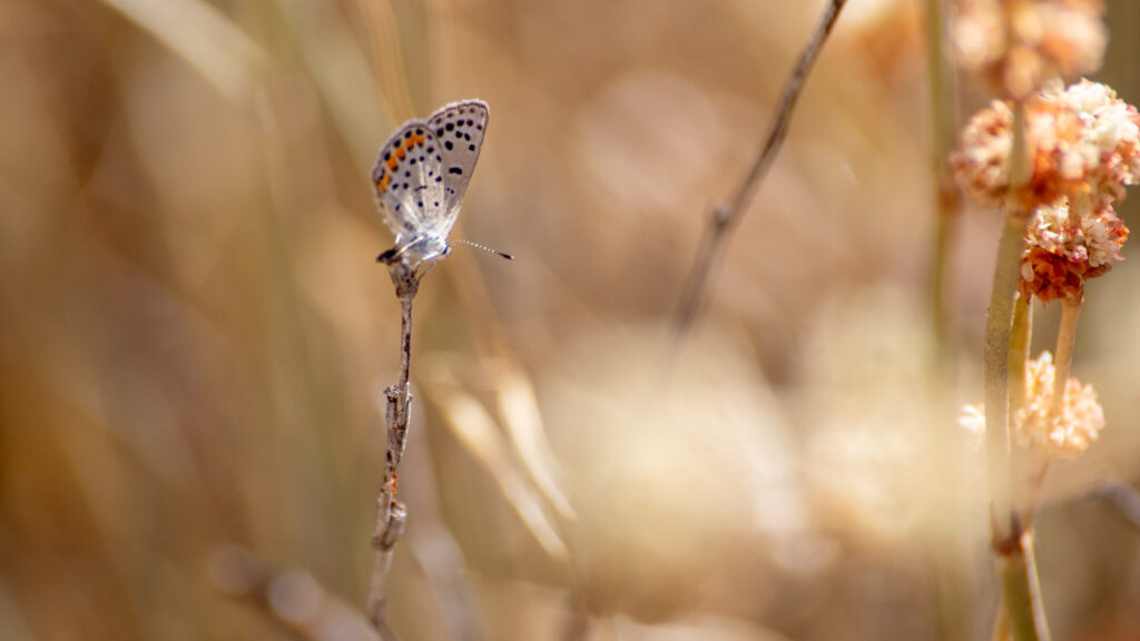
Despite the park’s small size and low visitorship, more than 500 species are cataloged in the nearby area on iNaturalist. A great deal of them are natives, thanks to the largely untouched nature nearby.
Protecting Fremont Peak
All of these unique features are absolutely worth protecting, but like just about anywhere else in California, this peak and the surrounding area is under the threat of development. In fact, the 159-acre park is surrounded by private land.
Before it was a state park, the mountain did see mining operations, and there’s still a risk of mining and other resource extraction in the nearby unprotected areas.
Hairstreak butterflies, among many others, can be found all over Fremont Peak.
For example, sedimentary limestone is still mined nearby to the west. Limestone is formed from deposits of carbonates. When heated and compressed, that limestone can be metamorphized into marble.
One of the best first steps in protecting the peak and surrounding areas is public awareness, and the best way to learn about the park is to visit it.
Visiting Fremont Peak State Park
Despite being a small state park, Fremont Peak offers camping, picnicking, and limited hiking. It’s perhaps most well-known for its significance in the astronomical community. Astronomers appreciate the peak for its very low light pollution.
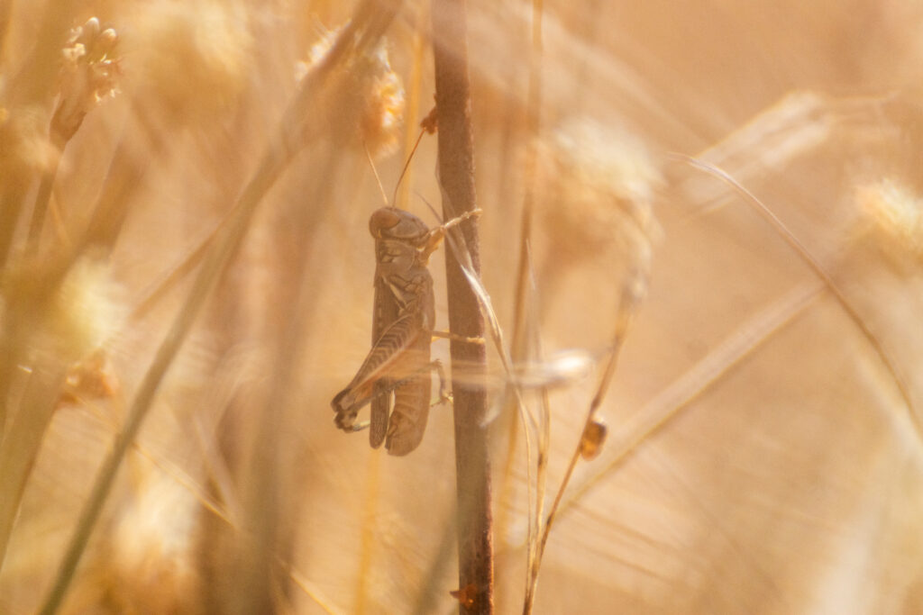
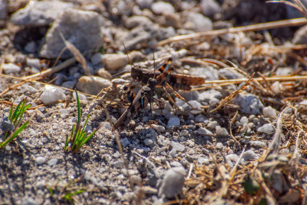
A grasshopper on a buckwheat stem.
Though the peak is surrounded by large developments, it’s said that the peak is just high enough to escape much of the surrounding light because of the presence of the marine layer coming from Monterey Bay. It’s a decades-old haven for local hobby astronomers.
Most Saturday nights in the summer, you’ll find mountain-goers with their eyes to the sky, thanks to the Fremont Peak Observatory Association, which operates an observatory at the park and hosts public stargazing events.
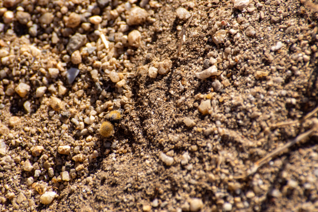
Velvet ants are quite formidable despite the fluff and can be seen at Fremont Peak State Park.
The park is located off Highway 156, 11 miles south of San Juan Bautista on San Juan Canyon Road. You can find a map, a detailed brochure of the park, and more information on fees and hours on the Fremont Peak State Park website.
The short 1.2-mile Fremont Peak Trail wraps around the mountain before ascending to the summit, with the same distance to return.
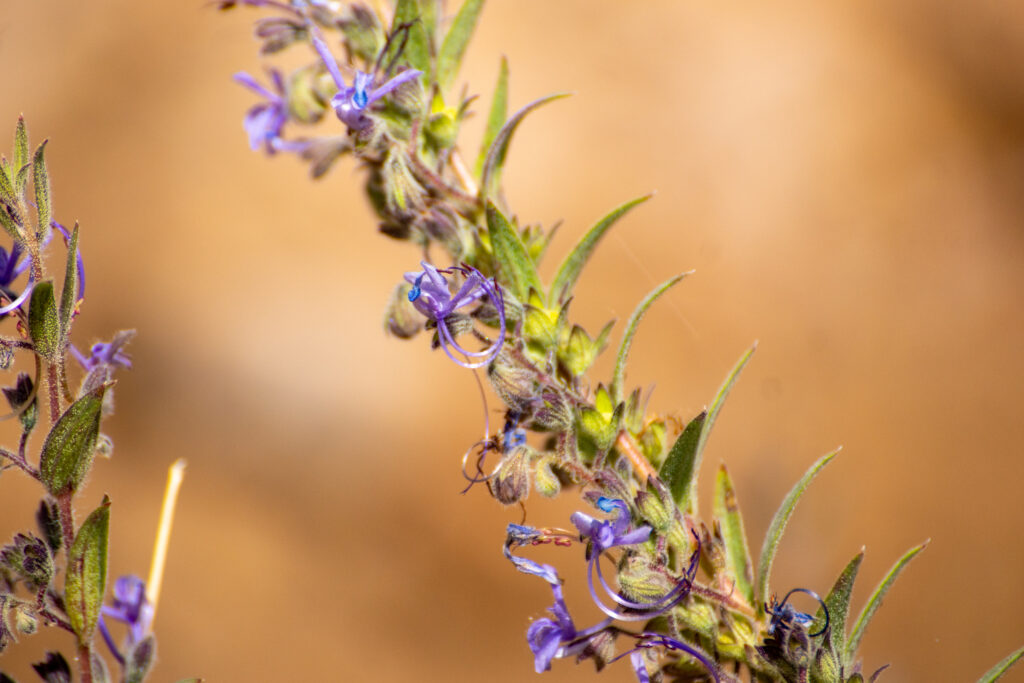
Vinegar weed (Trichostema lanceolatum) was in full bloom when visiting Fremont Peak.
The nearby historic San Juan Bautista De Anza Trail is a 5.2-mile out-and-back trail located near San Juan Bautista, California and extending over to the Salinas edge of the Gabilan mountains.
Save Mount Diablo is working on a recreational access map for San Benito County that will include both trails.
All photos by Alexander Broom

