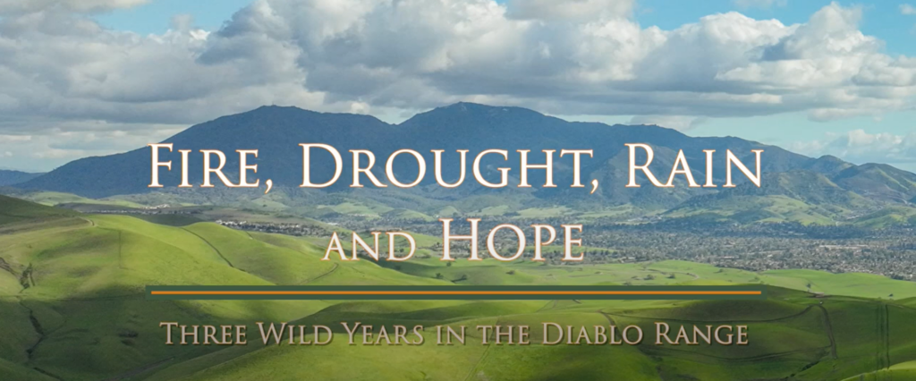
Below is a list of parks and other open spaces featured in our new film, Fire, Drought, Rain and Hope: Three Wild Years in the Diablo Range, arranged from north to south and including information on how to visit them.
Morgan Territory
Where the fire hit closest to home—and where rare plants bounced back by the millions on incinerated slopes.
Visiting Morgan Territory Regional Preserve
More information: Morgan Territory Regional Preserve | East Bay Parks (ebparks.org)
Where: 9401 Morgan Territory Road, Livermore, CA 94551
GPS coordinates: 37.81858386857998, -121.79587735493101
Size: 5,323 acres
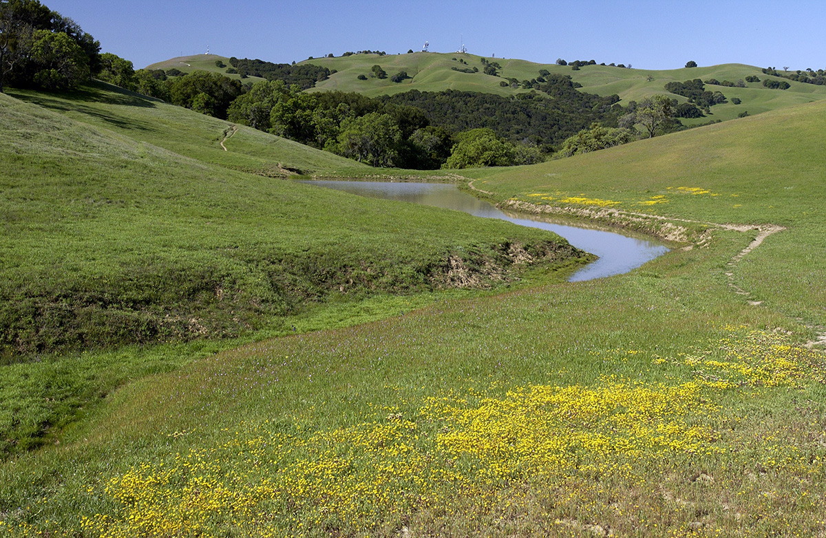
Morgan Territory Regional Preserve. Photo by Scott Hein
Description: Sandstone hills within the park are adorned in spring with more than 90 species of wildflowers, including the Diablo sunflower, which grows only in the foothills of Mount Diablo.
Deer, coyote, and even mountain lions may be seen here, and a variety of raptors frequently soar overhead.
Activities: biking, camping, hiking, horseback riding, picnicking, backpacking, trail running, birding, photography, painting, meditation, and wildlife viewing.
Dogs are allowed.
Permits/fees: No parking or dog fees.
Ohlone Wilderness
Where wildlife biologist Amanda Murphy studied rattlesnakes, Alameda whipsnakes, and whiptail lizards living in a vast open space on the urban edge.
Visiting Ohlone Wilderness Regional Preserve
More information: Ohlone Wilderness Regional Preserve | East Bay Parks (ebparks.org)
Where:
- Enter from Del Valle Regional Park: 7000 Del Valle Road, Livermore, CA 94550
- Enter from Sunol Wilderness Regional Preserve: 1895 Geary Road, Sunol, CA
- Enter from Mission Peak Regional Preserve: 43600 Mission Blvd., Fremont, Stanford Avenue Staging Area
GPS coordinates:
- Del Valle Regional Park: 37.56973586356729, -121.68733683162733
- Sunol Wilderness Regional Preserve: 37.516453885651586, -121.8319695906014
- Mission Peak Regional Preserve: 37.531859527819414, -121.91140747526957
Size: 9,737 acres
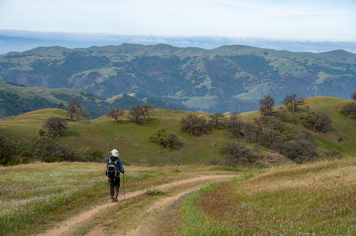
Ohlone Wilderness Regional Preserve. Photo by Scott Hein
Description: The Ohlone Wilderness Regional Preserve is a remote and beautiful wilderness area only accessible through hiking or horseback riding by way of the Ohlone Wilderness Trail from Del Valle Regional Park, Sunol Wilderness Regional Preserve, or Mission Peak Regional Preserve.
Its centerpiece is 3,817 Rose Peak, just 32 feet lower than Mount Diablo. The landscape is a nature photographer’s dream, with oak and bay woodlands, grassy uplands carpeted with springtime wildflowers, and wilderness ridges and peaks. The abundance of wildlife includes bald eagles, bobcats, deer, golden eagles, mountain lions, and tule elk.
Activities: camping, backpacking, hiking, horseback riding, birding, trail running, photography, and wildlife viewing.
The Ohlone Trail passes through the Ohlone Wilderness and three regional parks: Mission Peak Regional Preserve, Sunol Regional Wilderness near Pleasanton and south of Sunol, and Del Valle Regional Park.
The trail traverses 28 miles of mountains and canyons and has four campsites within the Ohlone Wilderness. With over 7,600 feet of elevation gain, this trail is not for beginners, but could be a good introduction to backpacking for a seasoned day hiker.
Hikers will enjoy scenic vistas and marvel at being in such a remote place so close to the metropolis of the Bay Area.
Dogs are allowed.
Permits/fees: Parking $5 weekends and holidays, $4 per trailered vehicle. $25 per bus. $2 per dog, guide/service dogs free. An Ohlone Wilderness permit is required for both day use and camping/backpacking for each person ages 12 years and older.
The fee for in-person purchase is $2/person/year; by mail/phone/online $4/person/year for the first five permits and $3/person/year for each additional permit after five.
A separate camping reservation is required if you plan to stay overnight at one of the designated campsites along the Ohlone Wilderness Trail.
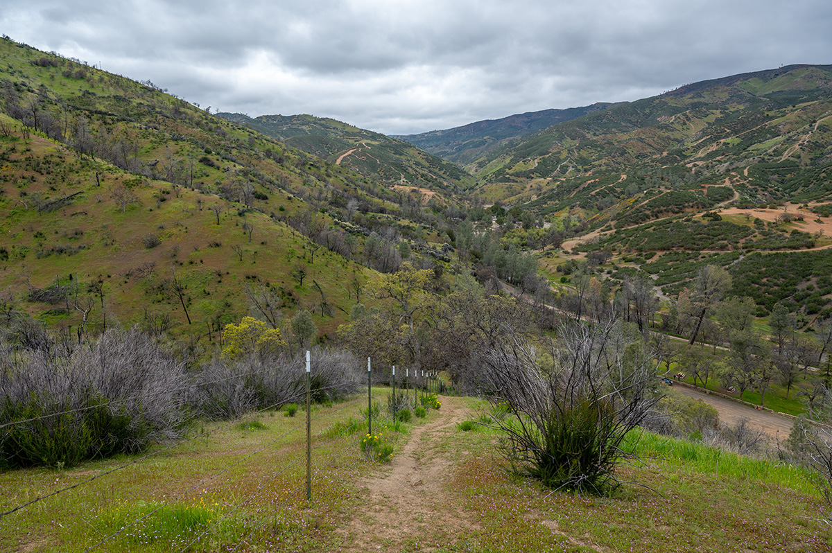
Del Puerto Canyon and Mount Hamilton
Where experts in insects, eagles, and other wildlife crossed the Diablo Range together on a soggy spring day in 2023.
Visiting Mount Hamilton and Lick Observatory
More information:
Where: 7281 Mount Hamilton Road, Mount Hamilton, CA 95140
GPS coordinates: 37.34231444742978, -121.64039996047676
Elevation range: up to 4,265 feet
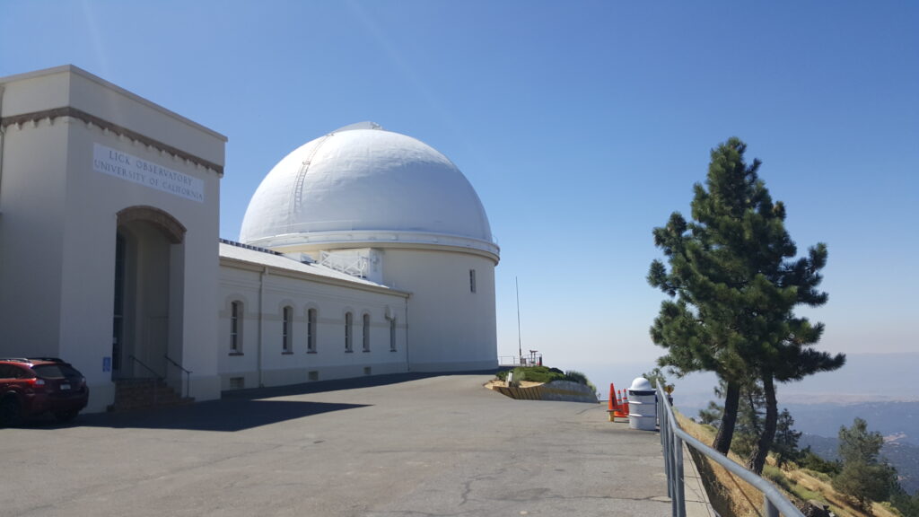
Lick Observatory, Mount Hamilton. Photo by Alexander Broom
Description: Mount Hamilton is a major stretch of wild land between Silicon Valley and the Central Valley. Urban development menaces Mount Hamilton, which is sandwiched between densely populated areas.
Conservation efforts here provide a refuge for endangered species such as the San Joaquin kit fox and the Bay checkerspot butterfly. Bobcats, mountain lion, tule elk, red-legged frog, and countless bird species all make their home in this diverse environment.
Mount Hamilton contains some of the most scenic and the most vulnerable natural settings in California. It supports majestic oaks, rare native grasses, and fields teeming with wildflowers.
Streamside forests, woodlands, and grasslands form a critical part of the watershed that guarantees a healthy water supply to Bay Area residents.
For a unique experience, the Lick Observatory sits atop Mount Hamilton’s peak and provides visitors with daytime and nighttime activities including walking tours, concerts, and celestial observations.
- Activities: Lick Observatory, stargazing, hiking, biking, trail running, picnicking, photography, painting, meditation, and wildlife viewing.
- Lick Observatory: Visitor Center is open 12 to 5 PM Saturdays and Sundays. Parking and admission are free.
- Hiking: there are 22 scenic trails in the Mount Hamilton area
Permits/fees: Joseph Grant County Park, which is located on Mount Hamilton, charges a $6 daily fee.
Visiting Frank Raines Regional Park and Minniear Day Use Area (Del Puerto Canyon)
More information: Frank Raines OHV | Stanislaus County Parks and Recreation (stancountyparks.com)
Where: 17802 Del Puerto Canyon Road, Patterson, CA
GPS coordinates: 37.426377243384785, -121.38135695767072
Size: More than 1,000 acres
Frank Raines Regional Park and Del Puerto Canyon. Photo by Scott Hein
Description: Frank Raines Regional Park in Del Puerto Canyon is an ideal destination for a multitude of recreational opportunities. A favorite for dog owners, campers, and off-roading enthusiasts alike, the region is ideal for play and beautiful wild land exploration.
The region has incredible species diversity, including rare fire-following flowers.
Frank Raines offers the rugged slopes of California’s Coast Range and is functionally divided into three units, separated by several miles of road.
The Minniear Area encompasses undeveloped land designed for non-motorized recreation use, perfect for a free hiking destination filled with amazing wildlife and scenic vistas. These biodiverse hillsides are especially spectacular during the spring and early summer as the serpentine hosts copious rare flora after the 2020 burn, including globe gilia, tufted poppies, golden eardrops, and whispering bells, to name a few.
The Frank Raines Day Use Area provides picnic tables, barbecues, a themed playground, and more. For campers and OHV enthusiasts, the Frank Raines Off-Highway Vehicle Park is located across from the day-use area.
Activities: camping, off-roading, mudding, motocross, deer and wild pig hunting, biking, hiking, trail running, volleyball, playground, RC crawling, horseback riding, photography, painting, picnicking, birding, meditation, and wildlife viewing.
Camping: Deer Creek campground is available by reservation with 34 full hook-up campsites.
Dog friendly.
Permits/fees: day use vehicle $5, camping $15-$30, hunting permits required.
Máyyan ‘Ooyákma–Coyote Ridge Open Space Preserve
Where activist-ecologist Stuart Weiss and the Santa Clara Valley Open Space Authority have helped make the city of San Jose safer.
Visiting Máyyan ‘Ooyákma–Coyote Ridge Open Space Preserve
More information: Máyyan ‘Ooyákma – Coyote Ridge (openspaceauthority.org)
Where: 9611 Malech Road, Morgan Hill, CA 95037
GPS coordinates: 37.21370197198247, -121.72092288287561
Size: 1,859 acres
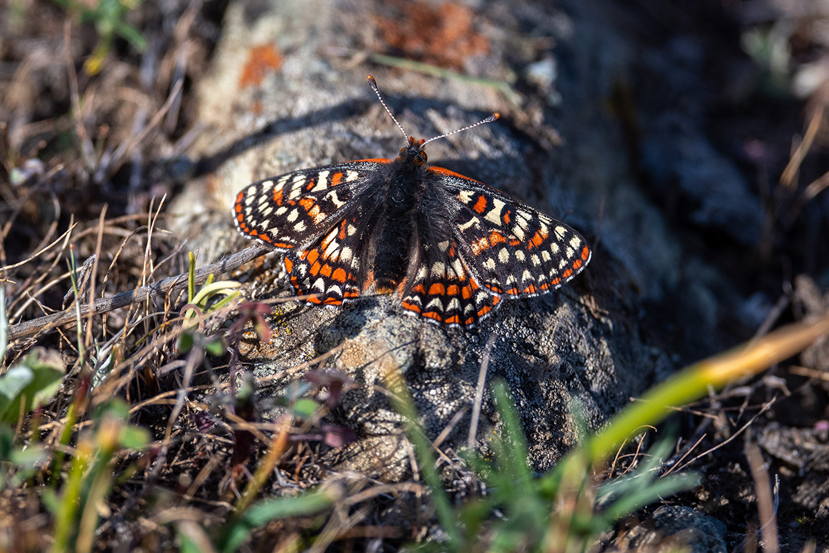
Bay checkerspot butterfly at Coyote Ridge Open Space Preserve. Photo by Scott Hein
Description: Only 20 minutes from downtown San Jose, Máyyan ‘Ooyákma–Coyote Ridge Open Space Preserve is the connecting point for over 1 million acres of important habitat in the Santa Cruz Mountains and the Diablo Range.Comprised of rare, sensitive serpentine grasslands, this unique landscape is a biodiversity hotspot for imperiled plants and animals such as the Bay checkerspot butterfly, Metcalf Canyon jewel flower, California red-legged frog, California tiger salamander, tule elk, western burrowing owl, golden eagle, and numerous birds of prey.
You can learn more about the endemic Bay checkerspot butterfly by joining a docent-led hike through the Habitat Protection Area to learn about this special pollinator and the wildflowers it relies on.
Activities: hiking, biking, horseback riding, picnicking, birding, photography, painting, meditation, wildlife viewing.
- Trails: three trails inside the Habitat Protection Area: Serpentine Spring Trail, Tule Elk Trail, and Bay Checkerspot Trail.
- March through May, the Habitat Protection Area will be open by reservation only on Saturdays and Sundays, during which time the public must sign up for a free docent-led hike or event to access the area.
- Horses are welcome, but because of limited parking, reservations are required for equestrians transporting horses in trailers. Horse trailer parking is available Wednesday through Friday by reservation only.
- Dogs are not permitted.
Permits/fees: “Butterfly Pass”: a free year-round pass required to access the trails inside the Habitat Protection Area. When you obtain a Butterfly Pass, you agree that you have read and agree to follow the preserve rules.
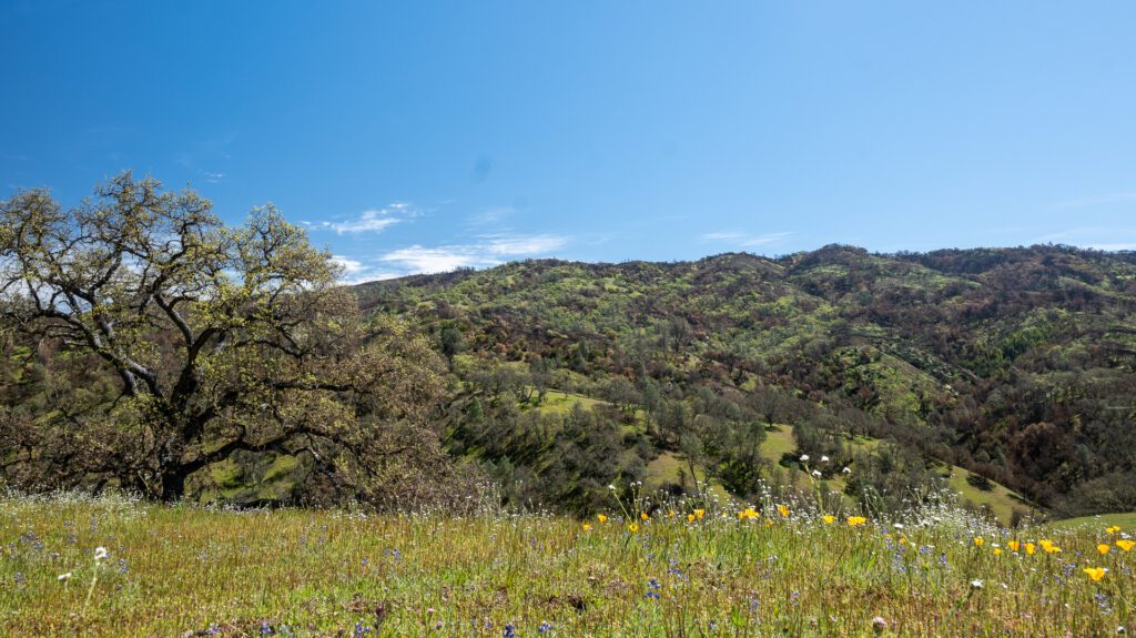
Henry W. Coe State Park
Where the fire made resource managers’ jobs easier in an expanse of wild country four times the size of Mount Diablo State Park.
Visiting Henry W. Coe State Park
More information:
Where:
- Main Coe Ranch entrance/visitor center: 9000 East Dunne Avenue, Morgan Hill, CA 95037
- Hunting Hollow entrance: 4826 Gilroy Hot Springs Road, Gilroy, CA 95020
- Dowdy Ranch entrance: Open on some weekends in April, but closed during Coe Backcountry Weekend on April 26-28. Call San Juan Bautista SHP and speak with Park Staff before you go. You can reach park staff every day between 10:00 am to 4:30 pm at 831-623-4881.
GPS coordinates:
- Main Coe Ranch entrance/visitor center: 37.18654011957993, -121.54617577409577
- Hunting Hollow entrance: 37.076090889706755, -121.4670592317707
Size: 87,000 acres
Elevation range: 300 to 3,560 feet
Henry W. Coe State Park. Photo by Bruce and Joan Hamilton.
Description: Henry W. Coe State Park is the largest state park in northern California. The park’s terrain is rugged, varied, and beautiful, with lofty ridges and steep canyons.
With such an expanse of wilderness, recreational opportunities are numerous and diverse. And with over 250 miles of hiking trails, it will take a long time to explore every corner of the park.
Spring is an incredible time to visit the park for the colorful display of wildflowers. The landscape is rich with blue lupines, orange-yellow California poppies, Mariposa lilies, larkspurs, wild hyacinths, and Ithuriel’s spears depending on the month you visit.
Activities: hiking, camping, backpacking, mountain biking, horseback riding, fishing, trail running, birding, photography, painting, picnicking, meditation, and wildlife viewing.
- Hiking: the park has over 250 miles of hiking trails and old ranch roads that can be traveled in all seasons. Hikes range from leisurely loops of a mile and a half with little elevation variations to highly ambitious backpacking loops of 50 miles or more with elevation gains and losses in the thousands of feet.
- Biking: the park has over 200 miles of roads and trails that are open to mountain bikes. The rugged terrain offers a variety of riding operations ranging from moderately difficult to extremely difficult. There are practically no easy trails for bikes. Bikes are to yield the right of way to hikers and horses.
- Fishing: Henry W. Coe State Park has great fishing, with largemouth bass, green sunfish, crappie, and bluegill in its lakes and ponds in addition to rainbow trout in the creeks. You cannot drive to any of the lakes or creeks. Most fishing ventures require considerable expenditure of time and energy into Coe’s backcountry. All state and federal rules apply and are enforced.
- Horseback riding and camping: there are six designated horse camps in the park. Each has a set of pipe corals that will hold at least two horses. All camps have a spring, pond, lake, or creek nearby, but these water sources are unreliable. Water must be purified for human consumption. Horse camp fees are $25 per night.
- Camping: Drive-in camping is available at the Coe Ranch entrance campground. Each of the 19 drive-in campsites has a picnic table and fire pit with a grill grate. Vault toilets and potable water are near each site. There are restrooms with flush toilets in the visitor center. There are no showers or RV hook-ups. Reservations are required or first-come, first-serve. Dogs are allowed in the campground, on paved roads, and on one trail.
- Backpacking: Permits are required and issued on a first-come, first-served basis at the Coe Ranch and Hunting Hollow entrances. Dogs and ground fires are not allowed in the backcountry.
- Dogs are allowed only at the Coe Ranch entrance in the Coe Ranch Campground, paved areas, and the 0.5-mile Live Oak Trail that connects the visitor center to the entrance parking lot. Dogs are allowed in the campground.
Permits/fees: Entrance fee is $8 for day use, drive-in camping is $20, group camping is $75, backpacking is $5, and horse camping is $25 per night.
Pinnacles National Park and Beyond
Where author and conservation biologist Joseph Belli “babysits” condors as a volunteer for the National Park Service and teams up with soulmate Seth Adams of Save Mount Diablo to survey wildlife in the range.
Visiting Pinnacles National Park (East/West)
More information: Pinnacles National Park (National Park Service) (nps.gov)
Where: 5000 East Entrance Road, Paicines, CA, 95043 / Soledad, CA 93960
GPS coordinates: 36.494438944565665, -121.14656873692363 / 36.47856000514703, -121.2258556656549
Size: 26,000 acres
Elevation range: gain up to 3,304 feet
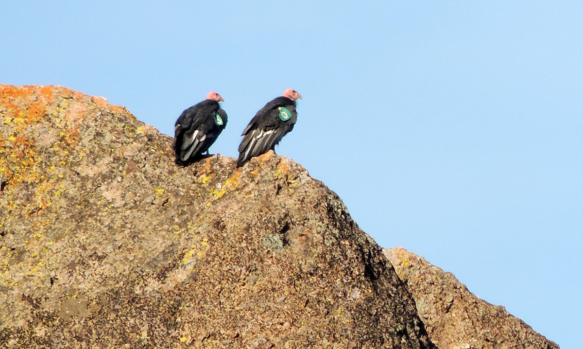
Pinnacles National Park condors. Photo by Sean Burke
Description: Some 23 million years ago, a volcano in Lancaster erupted, flowed, and traveled rocks some 200 miles to form what would become Pinnacles National Park. What remains is a unique landscape.
Travelers journey through chaparral, oak woodlands, and canyon bottoms.
Hikers enter rare talus caves, home to the largest maternity colony of Townsend’s big-eared bats between San Francisco and Mexico, and emerge to towering rock spires teeming with life: prairie and peregrine falcon, golden eagle, and the inspiring California condor.
The California condor is the largest land bird in North America, with a wingspan of almost 10 feet.
Pinnacles joined the California condor recovery program in 2003 and has helped recover condor numbers from the edge of extinction both in the wild and in captivity.
More than 48 mammal species, aside from humans, are known to occur within Pinnacles National Park. Those often seen and enjoyed by visitors and staff include black-tailed deer, bobcat, gray fox, raccoon, jackrabbit, brush rabbit, ground squirrel, chipmunk, and several kinds of bat.
There are reptiles like the coachwhip, and rattlesnakes as well.
Activities: camping, hiking, rock climbing, picnicking, birding, painting, trail running, photography, meditation, and wildlife viewing.
- Camping: Pinnacles is a popular camping spot, so book your reservation well in advance to guarantee a spot. The campground offers tent and group camping, along with RV sites. Each tent and group site has a picnic table and fire ring. Water is located throughout the campground. Coin-operated showers and a dump station are available.
- Hiking: there are more than 30 miles of trails that showcase the beauty of the park. Hikes range from flat stretches of grasslands to uphill climbs through talus caves onward to the rocky spires that Pinnacles is famous for. If you are new to the park, consult with a ranger at the Pinnacles East Entrance Station, the Bear Gulch Nature Center, or the West Pinnacles Visitor Contact Station.
- Rock climbing: the rocks are volcanic breccia. If you are used to granite, it is wise to take a cautious approach. If this is your first trip, you should lead well below your usual level to get used to the weak rock and often questionable or nonexistent protection. Wear a helmet, inspect all bolts carefully, test rocks as you go, and be prepared with the necessary gear including a headlamp with extra batteries and bulbs, extra clothing, and plenty of food and water.
- Birding: Birders of all levels and ages can hope to see not just the charismatic California condor, but some of the 181 other species that have been documented in the park. Birding is much more productive and satisfying with a pair of binoculars in the 7 to 10 power range.
- Pets are permitted in paved areas of the park, including parking lots, picnic areas, and the campground, but are prohibited on all hiking trails. Pets must be on a leash and attended at all times.
Permits/fees: Entrance fee is $15 to $30.

